Episode VI: Return Of The Northerly
Monday, 1 December 2014
Episode VI: Return Of The Northerly
Monday, 1 December 2014
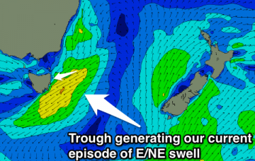
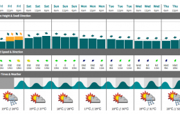
If model guidance is to be believed (and it’s hard to disagree right now) the next southerly change may not push through until next Wednesday afternoon on the Mid North Coast (more than nine days away), and sometime next Thursday morning in SE Qld.