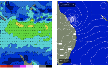
Surf likely to get L to XL as TC Alfred approaches CQ coast
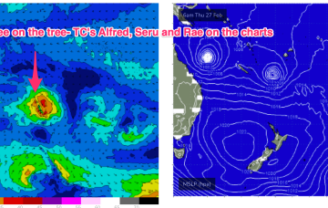
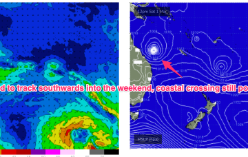
If we get the CQ crossing, very serious surf in the 8ft range or bigger is likely Mon into Tues.
High pressure is in the Tasman with three tropical cyclones currently on the map. NETas will see some smaller surf from these systems as well as NE windswell.
TC Alfred is in the Coral Sea, currently about a 1000km NE of Mackay and slow moving, expected to slowly track southwards from today. TC Rae has sped off SE to the graveyard and TC Seru is located between Vanuatu and Fiji and moving S/SE. In this complex brew, we’ll see multiple swell trains from the NE-E quadrant, although large swells may be confined to more northerly regions as models firm on a CQ coastal crossing for TC Alfred (still uncertainty over this track!) and the South Pacific cyclones track south-eastward, then eastwards as dissipating systems.
TC Alfred is in the Coral Sea, currently about a 1000km NE of Mackay and slow moving, expected to slowly track southwards from today. TC Rae has sped off SE to the graveyard and TC Seru is located between Vanuatu and Fiji and moving S/SE. In this complex brew, we’ll see multiple swell trains from the NE-E quadrant, although large swells are becoming increasingly unlikely as models firm on a coastal crossing for TC Alfred (still uncertainty over this track!) and the South Pacific cyclones track south-eastward, then eastwards as dissipating systems.
We've got three, back to back swells for the Mid Coast with OK winds, average down South.
The outlook from Friday is good with options right across the state with increasing swell pulses.
Good swell for the coming two days, slower thereafter.
The coming period is tricky both size and wind wise, better into early next week.
The trade-wind fetch is relatively robust and will be a long-lasting swell producer for the east coast, favouring sub-tropical areas for size. Confidence is low on the track for TC Alfred and thus it’s surf potential- a general slow southwards movement is expected which is favourable but we may still see a coastal crossing before the cyclone reaches it’s full potential as a surf generator.
The trade-wind fetch is relatively robust and will be a long-lasting swell producer for the east coast, favouring sub-tropical areas for size with some small swell filtering down to NETas through the week.