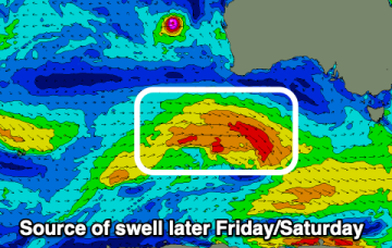
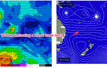
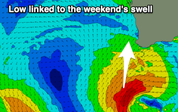
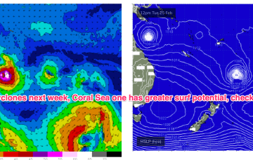
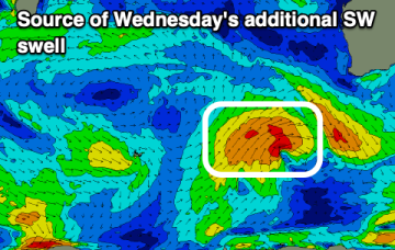
Fun surf from Wednesday, with a couple of larger pulses from the weekend
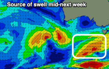
The coming outlook is favourable with fun swell pulses with generally favourable winds.
A very long and broad tradewind fetch is anchored on a NW/SE axis by twin tropical cyclones. TC Alfred is meandering in the Coral Sea NE of Cairns, while TC Rae is NW of Fiji and moving south-south westwards.
We've got plenty more fun swell pulses for the Mid Coast due, though today is the biggest and best.
A very long and broad tradewind fetch is anchored on a NW/SE axis by twin tropical cyclones. TC Alfred is meandering in the Coral Sea NE of Cairns, while TC Rae is NW of Fiji and moving south-south westwards.
Today's building west swell will ease over the coming days as conditions improve across the beaches. Building levels of W/SW swell are then due from later week through the weekend.
The run of small surf continues this period with generally favourable morning winds.
It's not looking epic, but there'll be fun surf days to work with this period.
Medium term surf potential rests on these tropical lows, with the supporting tradewind belt supplying plenty of energy in the interim, focussed on the sub-tropics.
High pressure has moved into the Tasman and sits there over the weekend. It’s quite a strong high (expected to strengthen from 1025 to 1030 hPa) with a typical wind signature for this time of year- mod/fresh SE winds in the sub-tropics, tending to NE winds in temperate NSW and extending down to Tasmania.
The monsoon trough is still active with a tropical low off the N.QLD coast and lows in the South Pacific through the Island chains. Medium term surf potential rests on these tropical lows, with the supporting tradewind belt supplying plenty of energy in the interim, focussed on the sub-tropics.