Average week, turning back on from the weekend

Victoria Forecast by Craig Brokensha (issued Monday 1st June)
Best Days: Thursday morning both coasts, Saturday onwards Surf Coast
Recap
Pumping waves Saturday (which I got to experience first hand) with Friday's inconsistent and strong W/SW groundswell easing as a new reinforcing SW groundswell filled in from the backside of the low. This provided good 4-6ft surf all day on the Surf Coast with larger waves on the Mornington Peninsula under fresh N/NW tending NW winds.
Sunday morning was a low point in swell activity with a moderate sized W/SW groundswell keeping 3-5ft sets hitting the Surf Coast and 6-8ft waves on the Mornington Peninsula under NW winds.
A strong new SW groundswell started to show from midday and build strongly through the afternoon back to 6ft to occasionally 8ft across the Surf Coast as winds tended more W'ly ahead of a mid-afternoon SW change.
Today the large SW groundswell was on the ease with generally poor conditions besides a lighter and brief period of W'ly winds around Torquay.
This week (Jun 2 – Jun 5)
The current SW groundswell, generated by a strong polar front pushing up and into us on Saturday will continue to ease through tomorrow and further Wednesday with generally poor winds.
A moderate to fresh S/SW'ly is due tomorrow with S/SE winds Wednesday, although Torquay may see an early W'ly at dawn tomorrow and more variable winds during the morning Wednesday, but it won't be worth the drive from Melbourne.
Come Thursday winds should swing offshore from the N'th across the Mornington Peninsula and N/NW on the Surf Coast but the swell will be small and only to 2ft west of Melbourne with 3ft+ sets to the east.
Friday is then expected to be tiny and with NW winds, there'll be nowhere to recommend for a surf. A late increase in new W/SW groundswell may be seen, outlined below.
 This weekend onwards (Jun 6 onwards)
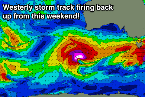
The outlook from this weekend is much better with some initial very inconsistent long-range W/SW swell due to be followed up by bigger, more consistent W/SW swell and a possible large W/SW groundswell Wednesday week.
This will be associated with a strong node of the Long Wave Trough slowly moving in from the south-west of WA this week and then across to us through next week.
Initially a series of vigorous fronts will be projected through our western swell window in the Indian Ocean, with a very inconsistent W/SW groundswell due to arrive later Friday and peak Saturday morning to 2ft+ on the Surf Coast and 4-5ft on the Mornington Peninsula.
A stronger and more inconsistent W/SW groundswell is due for the afternoon though, produced by a tight and very strong but unfavourably tracking mid-latitude low, pushing east-southeast from under WA on Thursday. This low is forecast to aim a tight fetch of severe-gale to storm-force W/SW winds towards us, stalling slightly more favourably in our swell window Friday. A W/SW tending SW swell is due, building to 3-4ft on the Surf Coast and 6ft+ on the Mornington Peninsula through the afternoon. Winds should be great all day as well with a fresh and gusty NW'ly.
This swell pulse should then ease into Sunday morning from 3-4ft and 6ft+ respectively, but a new consistent W/SW groundswell is due to build through the late afternoon, as a strengthening frontal system pushes in from the west Saturday evening and Sunday morning.
This looks to produce another medium sized W/SW groundswell, peaking Monday to 3-5ft on the Surf Coast and 6-8ft on the Mornington Peninsula. The strongest of all the weather systems moving through is then due early next week, possibly generating a large swell in the 6-8ft range for the Surf Coast Wednesday week, but we'll have a closer look at this again on Wednesday.
Comments
Hi Craig, are there any signs of some swell for this Friday, or is it definitely not worth a surf? I'm thinking of going down to jan juc but if there's no swell I'll give it a miss.
Not really until later in the day Tom and to 2ft at best. Not really worth a big commute.
Hey Craig,
I have been using your reports for a while and have always found them to be accurate, entertaining and helpful. Just wanted to say a quick thank you for doing what you do!
^^^
Thanks guys.
Craig would you ever consider getting payed to make the forecast look worse than it actually is?
Yeah that'd be ace hey Novak, so only men of character like us would know when it's going to be good. Amirite?
Although, once people see ol' Gazza tying the surf ski to the top of the Prius they know it's going to be ON.
novak , i hope you've got deep pockets , Craig and co are living off these guys drinking in all that " pro " provides ........
i must say i do feel for the " mid week " crew , its like this years been tailored for weekend warriors .
Lets hope it keeps getting colder...