Sloppy, short range surf on offer this week with a good looking weekend ahead

freeride76

Sloppy, short range surf on offer this week with a good looking weekend ahead

freeride76

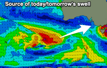
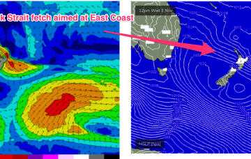
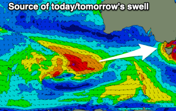
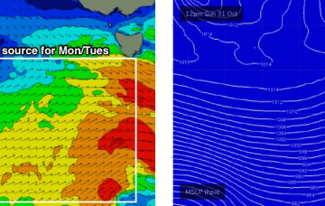
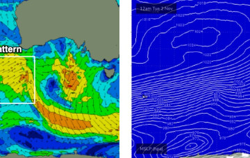
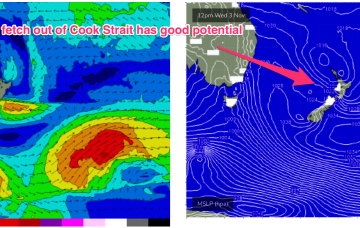
A large (1025 hPa) high pressure system is currently drifting over Central NSW into the Tasman sea and this high pressure cell is expected to track SE, strengthen and  become slow moving as it meanders near the South Island for most of this week. That creates a summer-style synoptic pattern, with SE/ESE Tradewinds through the sub-tropics and a N’ly flow through temperate NSW.

Juicy ESE swell on track for the end of the week

freeride76

Juicy ESE swell on track for the end of the week

freeride76

A low pressure system developing north of New Zealand’s North Island drifts south to be over the North Island Wed, and while that blocks most of the fetch from generating swell for the East Coast, it does shoot out a fetch through Cook Strait Wed/Thurs which looks like a tidy source of ESE swell for the region Fri/Sat.

Storm force low moves away rapidly during Sat, with winds and swell easing over the weekend

freeride76

Storm force low moves away rapidly during Sat, with winds and swell easing over the weekend

freeride76

No change to the headline feature: another robust low forming in a trough line East of Tasmania. It does seem to be running early, with gales to storm force winds now occurring out of Bass Strait through the early afternoon and severe gales expected to form adjacent to the East Coast overnight.