Not much surf, lots of snow potential
Monday, 23 May 2022
Not much surf, lots of snow potential
Monday, 23 May 2022
A small week ahead of some new, fun swell on the weekend. Windy and cold next week.
A small week ahead of some new, fun swell on the weekend. Windy and cold next week.
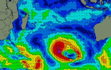
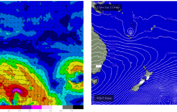
A strong polar low will develop below the state later this weekend and reach peak intensity on the eastern periphery of our swell window - i.e. below the Tasman Sea - early next week.
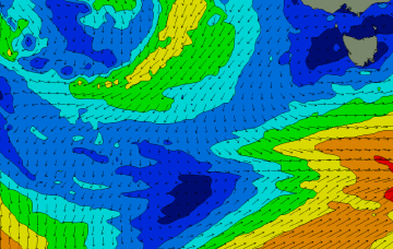
A large blocking high across our immediate swell window will impact our surf outlook in two ways for the first half of next week - it'll maintain low swell heights (by defecting storm activity away from our region) and it'll also keep conditions nice and clean with NE winds.
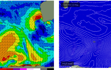
Into next week and we’re in for a couple of wild and wooly days as the front smashes into the state Mon, bringing wild weather and large storm surf mixed with long period groundswell.
No major changes to the weekend outlook, but a few slight tweaks.
High pressure remains west of Tasmania during Sat with weak SW winds on offer as fronts well to the south pass through the Southern Ocean.
Through the weekend, short range ESE swell from the tradewind fetch will supply the dominant swell trains, especially in CQLD.
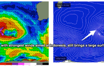
The Coral Sea has become inflamed with SE-ESE Tradewinds, enhanced by a trough off the CQ Coast and a developing low near New Caledonia. Through the weekend, short range ESE swell from the tradewind fetch will supply the dominant swell trains, especially in SEQLD.
The frontal progression responsible for the S swell pulses over the last couple of days is now on the New Zealand side of the Tasman, with a large high approaching Tasmania setting up a firm ridge along the coast.
The weekend will have plenty of swell and good winds, especially Saturday. Storms riding up a lobe of the long wave trough Wed/Thurs positioned favourably for WA swell production (and Indo) send plenty of moderate sized swell for the weekend.