Fun beachies to persist, then a round from the south

Sydney Hunter Illawarra Surf Forecast by Ben Matson (issued Wed Feb 21st)
Features of the Forecast (tl;dr)
- Fun trade swells with light mornings winds Thurs/Fri
- Potentially solid S'ly swells Sat (but windy) and Sun (better with generally light winds)
- Small local NE windswell developing Tues/Wed
Recap
Aside from a brief period of lingering fresh S’ly winds early Tuesday, we’ve seen generally light winds and fun waves across Southern NSW with a peaky mix of south and east swells around the 3ft mark, with lots of decent beachies on offer.
This week (Feb 22 - 23)
The rest of the week looks pretty fun.
Light NW winds are expected both mornings, which will create clean conditions, though freshening NE breezes may create some unwelcome bumps Thursday afternoon.
Friday afternoon will also see freshening N’ly winds across most locations as a southerly change pushes into the South Coast, reaching the Illawarra just after dinnertime (Sydney early evening, and the Hunter around midnight).
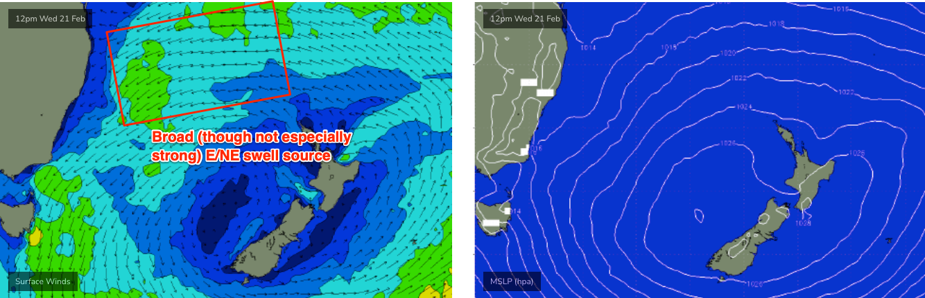
As for surf, we’re looking at a slight easing of southerly swell from today, but a continuation of peaky trade swell from the E/NE in the 2-3ft range, this time originating from the northwestern flank of a developing high in the eastern Tasman Sea (see below). This source is a little closer - and better aimed - to the Southern NSW coast than the previous trade swell, so consistency should ramp up a touch.
Either way it’ll be ideal for the wide open beaches before lunchtime both days.
This weekend (Feb 24 - 25)
Friday’s late southerly change will linger about the coast into Saturday, in particular the Central Coast and Hunter region could see a period of gusty winds. It'll be enough to put quite a dampener on surface conditions.
We’ll see an associated southerly windswell build across the region but it'll only be of low quality. Size should manage 3-4ft+ sets at beaches with good southerly exposure but there won’t be much to get excited about. Protected southern ends will be smaller though cleaner.
Sunday looks much better on the surface with light variable winds (still possibly a lingering southerly about the Hunter region early on) and improving conditions all round.
More promising is the swell outlook. Easing windswells from Saturday’s onshore flow will be replaced with building S’ly groundswells from the parent low, which will round the Tasmanian corner early Saturday. South facing beaches should show 3-4ft sets and some of the more exposed swell magnets (Hunter etc) may pick up 4-5ft waves. Beaches not open to the south will be smaller in size.
As such, flag Saturday and book in Sunday for a paddle, which is your best option this weekend.
Next week (Feb 26 onwards)
There’s still nothing major standing out in the long range charts at the moment.
The most interesting synoptic developments are a possible tropical cyclone in the northern Coral Sea (positioned outside of most swell windows), a strong zonal flow below the continent (again, aimed away from NSW’s swell window), and a coastal trough early in the week that may generate some local NE windswell Tues/Wed AM ahead of a return S’ly swell Wed PM and Thurs.
We’ll have more on that in Friday’s update.
Comments
Awesome arvo surf 3-4ft east swell cracking waves..after watching molly and jack win beer o’clock
You got that bit about that trade swell punching in on the south coast, coaly today friggen epic, best waves of the year.