Large swells and onshore winds continue
Friday, 9 August 2024
Large swells and onshore winds continue
Friday, 9 August 2024
Windows for a clean surf look very limited this period, even in metro locations.
Windows for a clean surf look very limited this period, even in metro locations.
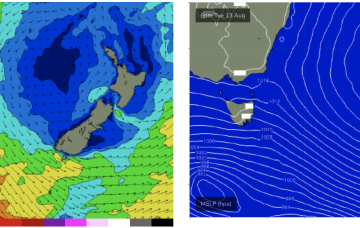
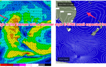
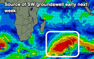
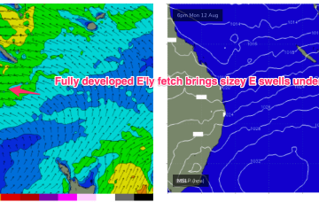
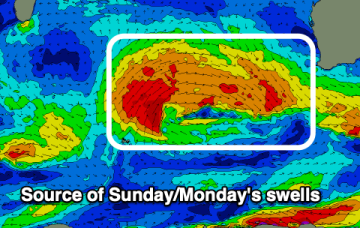
No change expected to the broad pattern next week with strong high pressure moving into the Tasman and a broad, deep E’ly fetch developing through the Coral Sea, with an embedded trough. That will be too far north to generate any meaningful swell for NETas under current modelling.
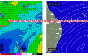
Most of the swell energy from this system will be aimed at sub-tropical targets, and we will see some real size from the E as winds feed into the trough. Unfortunately, with a straight onshore flow for the peak of the swell.
Today and the weekend look great for the Mid Coast and also down South.
No change expected to the broad pattern next week with strong high pressure moving into the Tasman and a broad, deep E’ly fetch developing through the Coral Sea, with an embedded trough. Most of the swell energy from this system will be aimed at sub-tropical targets.
For the Surf Coast, the coming days will be best under this west regime.
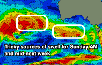
The coming forecast is very slow thanks to the storm track sitting too far north of us.
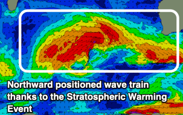
Happenings in the upper atmosphere are now filtering down to the surface bringing a poor outlook of weather and surf.
No change to the broad pattern expected next week which is strong high pressure in the Tasman and and deep E’ly fetch developing.