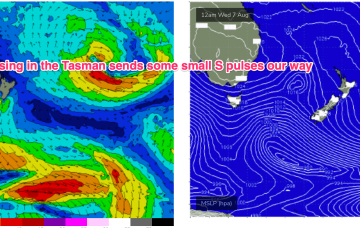
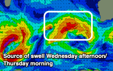
Not much on the radar, just some marginal NE windswell possible
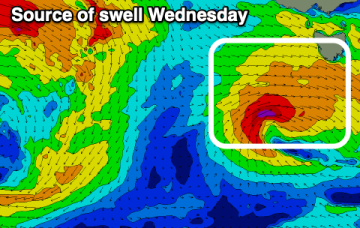
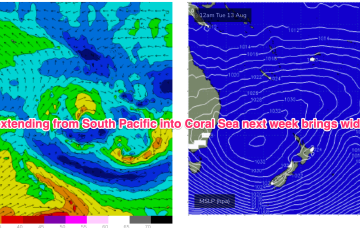
Zonal fronts under Tasmania are combining with high pressure over the continent to supply W’ly ridging.
By Tues we see late summer style sizey E’ly swells from a fully developed sea state across the Coral Sea.
We've got a great run for the Mid Coast with plenty of west swell and favourable winds.
Over the weekend and next week the large high complex builds a broad E’ly fetch through the South Pacific and into the Coral Sea, generating sizey E swells for the sub-tropics with smaller E/NE swells filtering down to temperate NSW.
The coming period looks fun but not overly sizey.
We've got an active run of large swells inbound.
The coming days will provide the most size of the period with tiny west swells to follow.
We've got a large run of swell due this period but with tricky winds for the South West, better across the north at times.
Into the mid next week and we should see some real size about as the persistent E’ly winds generate a fully developed sea state through our near swell window.
Zonal fronts below Tasmania will bring plenty of W’ly ridging but not much surf so we’ll see tiny surf develop this week.