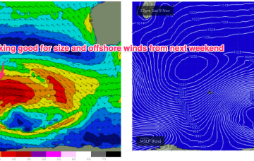
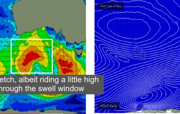
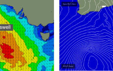
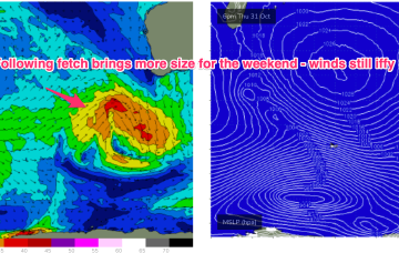
Fun options throughout the forecast period
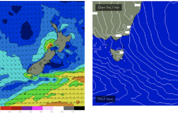
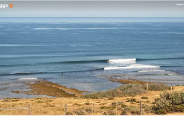
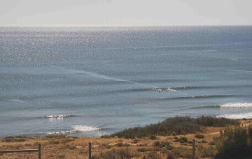
Surf size will ease into Saturday, and winds will freshen from the NE before tending N’ly through the day.
Next week still looks iffy for winds as a node of the long wave trough steers fronts into the SW while slow moving high pressure sits in the Central Indian Ocean. Those fronts will maintain a moderate sized series of SW pulses from Tues.
Saturday is your best chance for a wave this weekend. We've also got a solid swell for the start of next week.
We should see a weak, E’ly trade flow develop across the Eastern extremity of the Coral Sea and into the South Pacific slot later next week which would see some background E swell start to fill in later next week.
The freshening N-NE flow along the NSW temperate coast should generate some NE windswell through Wed PM, peaking Thurs
A shallow troughy change Mon looks to stall south of the MNC on Mon. If that current outlook holds we’re looking at a working week of N’ly winds and patches of NE windswell.
High pressure slides into the Tasman off the Central NSW coast while the remnants of a front scoot across the Tasman. The front will have generated a small flush of S swell.
A gusty S/SW change is due into the South Arm around 7-8am Thursday (give or take) so any chances of surfing will need to happen at dawn.
Next week looks little more active now as a fetch of SW gales over the weekend between 70-100E builds seas to 20ft.
No change to the short term outlook, with a front passing south of the state tomorrow expected to give the southerly airstream a little nudge.