Plenty of surf this weekend; narrow windows of OK winds
Wednesday, 20 June 2018
Plenty of surf this weekend; narrow windows of OK winds
Wednesday, 20 June 2018
We’ve got a few minor changes in store for the weekend outlook.
We’ve got a few minor changes in store for the weekend outlook.
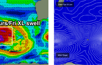
We’re still looking at a very significant groundswell arriving throughout Thursday, peaking in the late afternoon before easing slowly through Friday.
Our broader swell window has been devoid of activity for the last few days so we’re looking at an extended spell of tiny surf for the next few days.
The second half of the week looks much better for all and sundry.
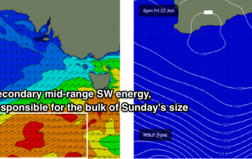
A secondary fetch developing west from Cook Strait around this time will bolster a SE fetch in the southern Tasman Sea, offering moderate SE swells through the middle of the week ahead of another pulse of slightly bigger E/SE swell through Thursday afternoon and Friday.
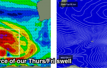
The source of this new swell is a powerful low pressure system currently in the Southern Indian Ocean.
A powerful low pressure system currently in the Southern Indian Ocean is generating a large, long period groundswell that’ll push our way for the weekend.
While all of this is going on, a much more significant system will have been tracking eastwards through the Southern Indian Ocean, generating a large groundswell that’s due to arrive Thursday.
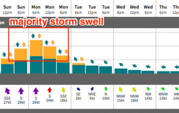
Monday will see a peak in short range southerly storm swell, with strong to gale force winds accompanying form the same direction.
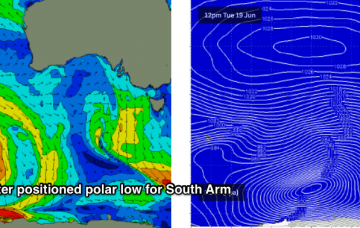
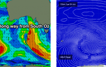
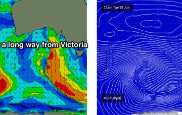
The synoptic chart looks very impressive with a deep low immediately to our south, and Cape Sorell buoy showing a lot of energy - however the main fetch around the western flank of the low is outside our swell window, aimed up into SA and western Vic.