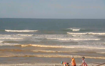
Average period with onshore winds spoiling the peak in swell energy
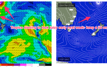
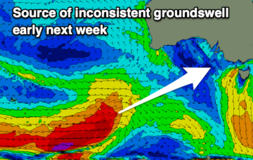
There's not much to work with this period unfortunately. There's a bit of swell inbound but with average winds.
Models are now firming on a large tropical depression (possibly a TC) drifting southwards into the slot between New Caledonia and the North Island from mid next week. A broad, slow moving area of E’ly low end gales is likely on the southern flank of this system, initially favouring the sub-tropics, but radiating down to temperate NSW through next weekend.
Clean surfing windows will be limited this period so try and pick the best out of it.
Strong high pressure (1035 hPa) is now moving SE of Tasmania with an embedded trough along the advancing ridge ramping up wind speeds from the SSE-SE into the 20kts+ range. Conditions should settle as the high moves into the Tasman and weakens and the ridge relaxes through the end of the week. The high is augmenting an existing SE-ESE tradewind fetch through the Northern Tasman and Coral Seas and maintaining small E-SE swell.
Monday looks even juicier. An approaching trough of low pressure tightens pressure gradients and the fetch really winds up in the swell window.
Windy, easing surf into the end of the week with a good new swell early next week but with dicey winds.
Strong high pressure (1035 hPa) is now moving SE of Tasmania with an embedded trough along the advancing ridge ramping up wind speeds from the SSE-SE into the 20kts+ range. Conditions should settle as the high moves into the Tasman and weakens and the ridge relaxes through the end of the week. The high is augmenting an existing SE-ESE tradewind fetch through the Northern Tasman and Coral Seas and maintaining small E-SE swell.
Fun sized swells with favourable winds from Friday through Monday, mostly tiny in Perth.
Winds will be offshore to end the week but the surf will be tiny and fading. Some fun W/SW swell is due on the weekend.
Strong high pressure (1035 hPa) is now moving SE of Tasmania with an embedded trough along the advancing ridge ramping up wind speeds from the SSE-SE into the 30kts+ range. Conditions should settle as the high moves into the Tasman and weakens and the ridge relaxes through the end of the week.