Plenty of S to SE swell this week as low hovers in Tasman
Monday, 16 October 2023

Plenty of S to SE swell this week as low hovers in Tasman
Monday, 16 October 2023
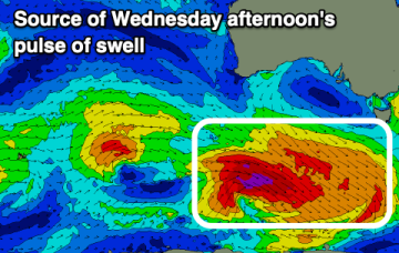
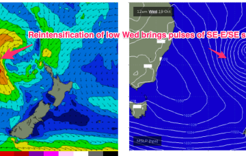
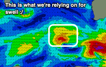
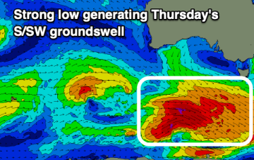
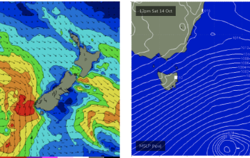
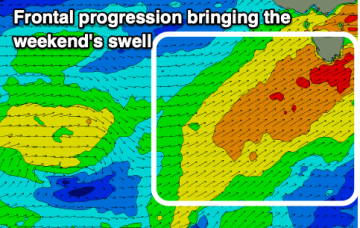
A strong front and embedded trough of low pressure are currently located just off the Gippsland Coast, expected too move NE into the Tasman and driving a strong/ near gale force S’ly flow up the NSW Coast today, reaching the QLD in the wee hours of Tuesday. There’ll be an initial burst of S swell associated with the proximate fetch, with some better quality SE-E/SE swell from a secondary intensification of the low as it becomes slow moving near New Zealand.