Extended run of surf ahead
Monday, 4 March 2024
Extended run of surf ahead
Monday, 4 March 2024
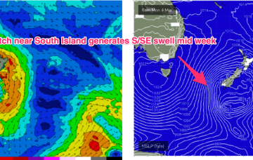
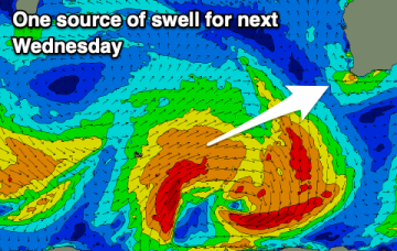
We should see rideable surf develop through Wed as a SE surge builds across the region and extends out into the Coral Sea.
We should see rideable surf develop through Wed as a SE surge builds across the region and extends out into the Coral Sea.
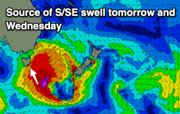
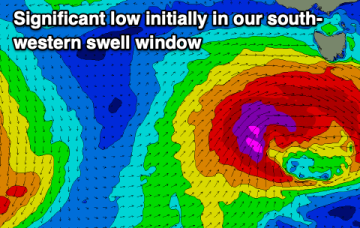
Current ASCAT (satellite windspeed) passes show a long fetch of severe gales in the southern swell window and wave buoys are all in an aggressive upwards curve as strong S swells propagate along the Southern NSW Coastline after making landfall in Tasmania.
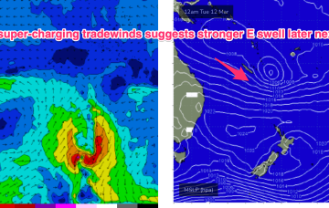
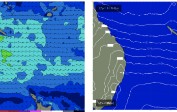
Current ASCAT (satellite windspeed) passes show a long fetch of severe gales in the southern swell window and wave buoys are all in an aggressive upwards curve as strong S swells build along the Southern NSW Coastline. We’ll see strong pulses of swell from this system until Thurs with easing leftovers until the end of the working week. To the north an extended trade-wind fetch is setting up through the week with another long playing E’ly swell event from that pattern, favouring the sub-tropics for size.
We currently have a deep, winter-calibre double-headed low traversing the lower Tasman. Current ASCAT (satellite windspeed) passes show a long fetch of severe gales in the southern swell window and wave buoys are all in an aggressive upwards curve as strong S swells build along the Southern NSW Coastline.
Conditions should improve over the coming days with plenty of swell still in the tank.
A couple of good quality swells are due this period, though with a weaker, windy swell in between.
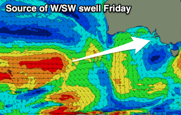
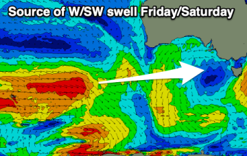
This morning's large S'ly swell will ease under favourable winds tomorrow, with some fun new W/SW swell due late week.
This morning's large S/SW groundswell will ease rapidly as winds and conditions improve into tomorrow. Some fun W/SW swell should follow into the end of the week.
You'll have to work the winds this period with a series of moderate to large swells due.
The current swell will ease into the weekend, slowed by a reinforcing pulse of energy later tomorrow.