Slow week of waves, then a dynamic weekend

South Arm Forecast by Ben Matson (issued Monday May 12th)
Features of the Forecast (tl;dr)
- Small clean waves Tues/Wed/Thurs but low confidence for anything worthwhile
- Building swell Fri but with an onshore change in the arvo
- Solid windy swells Sat, easing Sun with a chance for some small waves on the points
Recap
Saturday delivered fun clean 2ft leftovers before a new S/SW swell built from 2ft to 3ft+ through Sunday, easing to 1-2ft this morning. The whole period has seen clean conditions with light offshore winds.
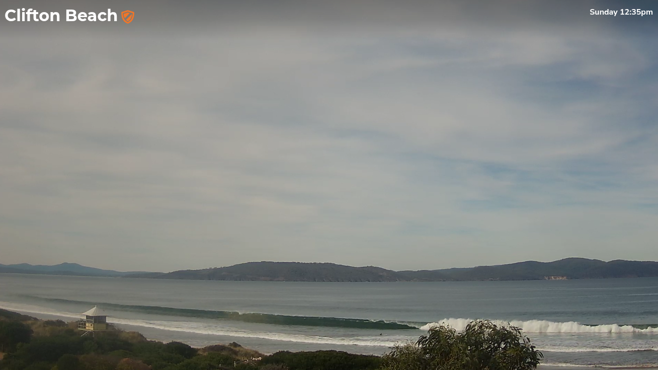
Strong groundswell lines around lunchtime Sunday
This week (May 13 - 16)
Small waves will persist on Tuesday despite the expected presence of long period swell. This energy was generated by a small, tight fetch near Heard Island mid-last week and most of its size will have decayed since generation (due to the large travel distance), so we’re looking at inconsistent leftovers in the 1ft range across South Arm beaches.
The latter stages of the same low (responsible for the absent long period energy on Tuesday) is developing a slightly better swell for the afternoon, but it’s not looking like a strong, consistent event at all. We may see some stray 2ft sets into the afternoon but I’m not confident there’ll be much on offer.
Although the forecast from Wednesday onwards suggests windy conditions (as a succession of strong fronts whizz past the state), local effects inside Storm Bay should initially keep wind speeds light to moderate, and from the NW. So conditions should remain clean until about Friday.
These fronts are poorly aligned within the South Arm’s swell window (very zonal and a little too far north in latitude than is ideal), so we’re looking at small weak waves both Wednesday and Thursday in the 1-2ft range tops. Keep your expectations low.
Friday is where things will start to get more interesting.
A strong conveyor belt of fronts through the Southern Ocean - initially unfavourably aligned through our swell window - will generate a series of groundswells that will overlap through the latter part of the week ahead of a peak in size over the weekend.
Early indications are for Friday to build into from 2ft to 3-4ft through the day, however we will also see a front cross the coast at the same time, delivering a gusty SW wind change.
So let’s see how Wednesday’s model runs are stacking up.
This weekend (May 17 - 18)
The peak of this swell cycle is expected on Saturday, generated by an strengthening polar low at the tail end of the frontal progression, which will - as luck would have it - develop immediately SW of the state, within our prime S/SW swell window.
Unfortunately, we are expecting moderate to fresh W/SW winds to accompany the peak in swell energy.
But, the good news is that the swell direction should have enough size and south in its direction to offer some small peelers along the regional points.
At this stage I’m expecting 4-5ft surf at exposed beaches on Saturday, easing slowly through Sunday, but we’ll see how the models are faring on Wednesday.
Next week (May 19 onwards)
Looking further ahead and there’s nothing of any significance on the long term radar right now. I’ll have more on that in Wednesday’s update.
Comments
Looks like that pulse is starting to show nicely, it's a little bigger than expected.
Our new upgraded model (not yet live) has been slightly overcooking wave heights through the South Arm - something we're working on toning down a little - but it picked this pulse really well. You'll also notice the better wind forecast too.
Current model:
New model: