Brief windows of opportunity; nothing amazing

South-east Queensland and Northern NSW Surf Forecast by Ben Matson (issued Friday 7th September)
Best Days: Sat: pockets of peaky surf if you're lucky to pick up a brief period of NW winds. Sun/Mon: small, very inconsistent waves across outer points. Tues/Wed: easing S'ly winds and a peaky mix of inconsistent swells, mainly distant E'ly.
Recap: Thursday morning offered a brief window of fun leftover E’ly and SE swells before the northerly kicked in, and today’s generally been a write off under the small swell/northerly regime. However this local airstream is quite robust and is slowly building N’ly windswells about exposed beaches (seems to be around 2-3ft now).
This weekend (Sep 8 - 9)
Today’s Forecaster Notes are brought to you by Rip Curl
A trough will move up the coast on Saturday, reaching Coffs Harbour late in the day and then pushing north across remaining coasts overnight.
Prior to its arrival, we’ll see light W’ly winds across the Mid North Coast, but fresh N’ly winds north of Coffs Harbour. There’s a reasonable chance for a period of NW winds at some locations through the early morning, but it’s certainly not a sure bet.
However, it is worth looking for a sheltered northern corner, as we’ll see a combination of small N’ly windswell and small inconsistent E/SE groundswell, originating from a fetch exiting western Cook Strait mid-week. The N’ly windswell will be largest across Far Northern NSW - and will ease during the day - with smaller size south from Coffs and also north from the Gold Coast.
The E/SE swell won’t offer a lot of options but mixed in together could provide some interesting peaks if you luck into a window of nor’westers. We should see occasional 2-3ft+ sets at swell magnets south from Byron (the E/SE swell being the larger of the two), with smaller surf elsewhere.
As the change spreads north into Sunday, we’ll see very small leftover N’ly windswell but the E/SE swell from Saturday should remain in place, generally around the 2-3ft+ mark at exposed beaches south of Byron, and a foot or so smaller at exposed spots north of the border, smaller again across the points. Unfortunately exposed beaches will be generally bumpy under the southerly so don’t expect anything amazing.
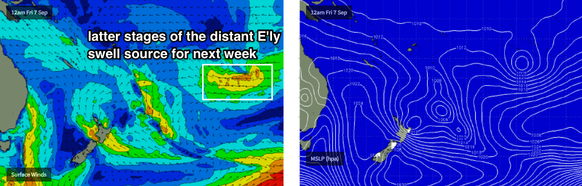
Also in the mix all weekend will be a very inconsistent, distant E’ly groundswell generated by that broad easterly fetch atop the enormous high pressure system SE of Tahiti earlier this week. It’s really hard to have size confidence from such a remote system, but all exposed regions are certainly within range to see stray 2-3ft sets - they just be twenty minutes of more between sets at times.
Next week (Sep 10 onwards)
Model guidance slightly boosts the distant E’ly swell across our coasts through late Monday and into Tuesday, though I’m doubtful that we’ll see much more size than 2-3ft+ and sets will remain very inconsistent from this source. Expect long waits for the bigger waves, especially across the outer points where it'll be slow going at times. This swell should provide rideable surf through the middle of the week.
The forecast for the rest of the week maintains small surf from a couple of flukey sources. The Southern Ocean frontal conveyer belt looks like it’ll be slightly out of alignment for us, so we’ll just see minor long period energy glance the Northern NSW from Tuesday thru’ Friday. Most days won’t deliver much size but a few of these swells may monetarily perk up south facing beaches into the 2-3ft range (late Tues/Wed the best window, if anything).
We’ll also see some small off-axis S/SE swell from the fetch trailing the weekend’s Tasman trough, though no great size expected.
Long term - beyond the end of next week - suggests a possible ridge through the Northern Tasman Sea and a mid-range E’ly swell source, but this is still quite some time away.
Have a great weekend, see you Monday!
Comments
Coupla peaky options on the Goldy this morning before the southerly kicks in.

I am going to tow the north island out of our swell window.
A bit of east energy out there which is good