North, south, north, south
Monday, 30 November 2020
North, south, north, south
Monday, 30 November 2020
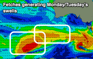
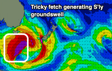
We've got swells from either side of the compass this period, firstly north, then south, then north, then south again.
We've got swells from either side of the compass this period, firstly north, then south, then north, then south again.
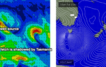
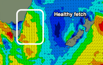
The main synoptic feature is a deep Southern Ocean low that's expected to *almost* bomb just W/SW of Tasmania. By ‘almost’, I mean ‘not quite reach the threshold requirements for a bombing low’, which is a 24hPa drop in 24 hours, though it certainly will come pretty close. More in the Forecaster Notes.
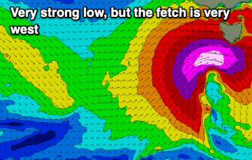
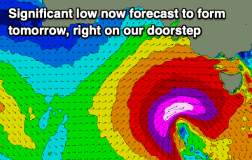
A significant low is forecast to form in our swell window tomorrow, with plenty more swell to follow.
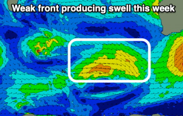
The surf outlook following today's strong cold front is the quietest it's looked in a while.
A significant, strong low is set to form south of us tomorrow, bringing another large swell.
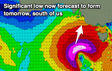
A deep, powerful low will develop in our swell window this period, generating a large, significant swell.
You can essentially forget almost the entire weekend. Why? Gusty northerly winds. But, next week has options. More in the Forecaster Notes.
The weekend outlook is pretty complex. Next week, even more so. More in the Forecaster Notes.
The weekend looks a miss rather than hit, but we've got a couple of interesting swell sources developing for next week.
A slower weekend, poor Sunday while next week we've got plenty of swell on the way from different sources.