Better late than never!
Monday, 26 August 2024
Better late than never!
Monday, 26 August 2024
We're finally looking at the most active outlook we've had this winter.
We're finally looking at the most active outlook we've had this winter.
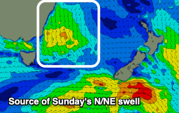
There is also a risk of northerlies through this period, but we’ll take a closer look at the specs on Monday.
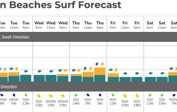
The coming period will become slow as the zonal westerly pattern kicks in across the state.
A strong cold front will cross Victoria on Sunday afternoon, and we’ll see W/SW gales exiting eastern Bass Strait on Monday.
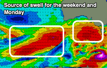
The weekend looks hit and miss, best Sunday with no major surf to follow until late next week.
The weekend and most of next week is a write off for most spots.
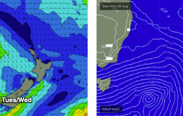
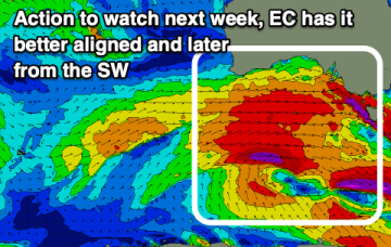
A shift in the westerly storm track closer towards us over the coming week and a bit will bring some proper, winter swells and activity.
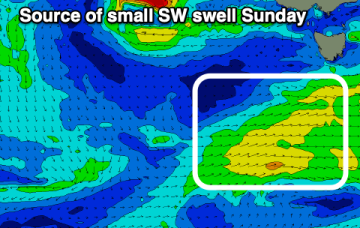
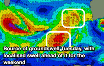
Make the most of today's spike of swell before focussing on later next week onwards.
Large swells into early-mid next week across all locations.
There’s just enough strength in the tradewind flow through the central Coral Sea to see some small surf develop across the CQ coast. That should hold surf into Sat before easing.