Large episodic winter swells
Wednesday, 28 August 2024
Large episodic winter swells
Wednesday, 28 August 2024
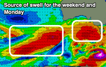
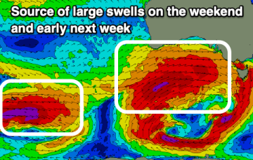
We've got an extended run of large, winter swell starting from today, extending into the middle of next week.
We've got an extended run of large, winter swell starting from today, extending into the middle of next week.
We've got an excellent run of surf for the coming period.
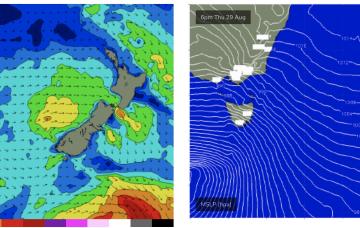
Easing surf for the coming days with an active but more subdued outlook.
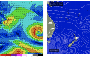
This period looks a lot more active with strong pulses of westerly swell due.
A fetch well to the SE of Fiji this week will supply a small, background signal of E swell from Wed for those spots with open access to the E.
The pattern of strong, zonal W’lies tied to polar lows and embedded cold fronts and weak mobile high pressure won’t offer much for NETas but we will see some small NE swells generated by radial spread from gales out of Bass Strait this week.
The coming period will be generally onshore with very limited windows of lighter winds.
The pattern of strong, zonal W’lies tied to polar lows and embedded cold fronts and weak mobile high pressure won’t offer much north of Seal Rocks but we will see some small S swells generated by gales out of Bass Strait this week with a mostly NW-W flow across southern NSW and NW-N in the sub-tropics. There’ll be a few small windows, favouring the MNC.
The pattern of strong, zonal W’lies tied to polar lows and embedded cold fronts and weak mobile high pressure won’t offer much north of Seal Rocks but we will see some small S swells generated by gales out of Bass Strait this week with a mostly NW-W flow across southern NSW and NW-N in the sub-tropics.
We've got large pulses of W/SW groundswell on the way with winds out of the western quadrant.