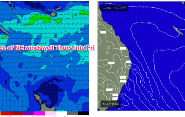
Nagging onshore flow with sizey surf improving by the weekend
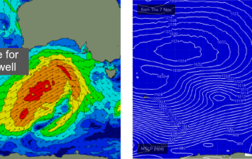
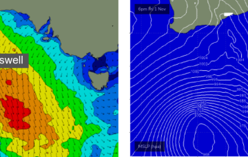
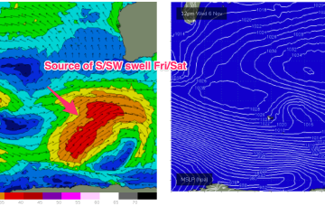
A polar low flares up as it approaches a more southern point of the WA swell window Wed, with gales to severe gales expected.
Easing swells are expected on Tuesday with generally light variable winds and sea breezes expected to maintain favourable conditions.
No real winds of swell generating significance in the Coral Sea this week. We may see just enough energy in the Coral Sea to generate a tiny wave late this week into the weekend.
I like the look of this weekend. Next week looks slower so make the most of the short term period.
We’ll be relying on some small NE windswell episodes and great circle paths under the continent to deliver some flukey S groundswell short and medium term.
Very quiet across the entire spectrum of the East coast swell window at present. Weak high pressure near New Zealand is being shunted away by another weak high cell moving into the Tasman overnight into tomorrow. Troughiness continues with a slow moving trough line semi-stalled across the MNC this week.
We’ll be relying on some small NE windswell episodes and great circle paths under the continent to deliver some flukey S groundswell short and medium term.
Saturday is your best chance for a wave this weekend.
Surf size will ease into Saturday, and winds will freshen from the NE before tending N’ly through the day.
Next week still looks iffy for winds as a node of the long wave trough steers fronts into the SW while slow moving high pressure sits in the Central Indian Ocean. Those fronts will maintain a moderate sized series of SW pulses from Tues.