Blustery period ahead, not a lot of surf though
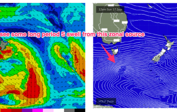
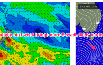
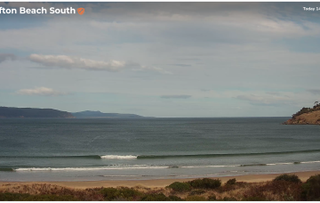
We've got a whole week of windy westerlies on the cards as a strong conveyor belt of fronts cross the state.
As for surf, the overarching trend is for several overlapping pulses to provide plenty of waves across both coasts, though it'll be a slow start down south owing to the dominant westerly direction.
We've had another further uptick in size potential for the weekend, though I am trying to keep my expectations in check due to the dominant westerly swell direction.
Mid week, the blocking pattern breaks down and we see another series of powerful disturbances track NE of Heard Island with multiple swell generating fetches becoming active again in the SE Indian Ocean from mid-late next week. With another series of gale to severe gale force fetches active we’ll see another period of over-lapping swell trains and elevated wave heights across the SW corner, likely with onshore winds again reflecting the northwards located high.
No change to the forecast. The weekend looks great with building E’ly swells from a broad, angular tropical depression centred around New Caledonia.
No great change to the weekend f/cast. High pressure in the Tasman and a W’ly biased ridge across Tasmania as fronts and a deep low pass to the south.
A mixed bag still expected this weekend with residual S swell trains and building E-E/NE swells from a broad, angular tropical depression centred around New Caledonia.
A trough hovering about the South Coast will see a N’ly flow through Sat, with good odds for a morning NW breeze and a late tilt back to the NW, especially south of Sydney. Further north freshening N’lies look more likely. A few leftover S swell trains should hold some 2 occ 3ft sets at S facing beaches but energy will be in the way down.
The models have now cooled on the prospects of a stalled LWT below the continent next week, instead swinging towards a mobile frontal passage through the Southern Ocean.
There’s been a slight improvement in the weekend outlook - for Victor, anyway - with the models strengthening a series of fronts through the Bight. The Mid's looking great too!