Workable mixed bag of swells continues the current spring pattern

freeride76

Workable mixed bag of swells continues the current spring pattern

freeride76

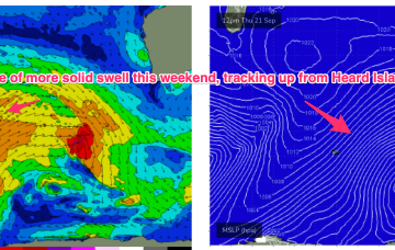
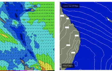
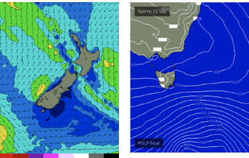
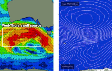
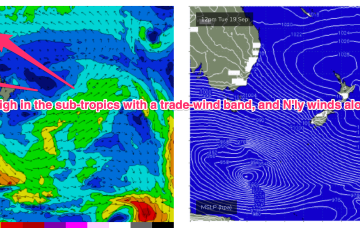
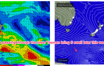
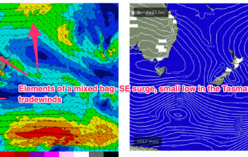
High pressure is now close to New Zealand, with an advancing trough and cold front bringing a fresh S’ly change, expected to generate a strong SE surge up the sub-tropical coast as a new high moves into the Bight and strengthens. Once the high moves into the Tasman over the weekend it’ll set up a blocking pattern but we’re expecting a few small S pulses leading up to that although winds look fickle. E'ly swell from persistent tradewind fetches should continue as a fun background source of swell.

Active Indian Ocean continues to generate plenty of swell with a few windows of clean conditions this week

freeride76

Active Indian Ocean continues to generate plenty of swell with a few windows of clean conditions this week

freeride76

Keep an eye out for super long period W/SW swell from an African storm we mentioned last week. These swell periods will be in excess of 20 seconds, through Thurs into Fri. Not the main swell source but still supplying some long range energy into the mix. 

A few small swell sources to work with this week, continuing into the weekend

freeride76

A few small swell sources to work with this week, continuing into the weekend

freeride76

We’ve got another slow moving pattern on our hands to start the week with a high pressure belt at sub-tropical latitudes directing a N’ly flow across the state and a very zonal (W-E) storm track tracking through the far southern Tasman Sea. A tradewind band has weakened and contracted eastwards but is expected to remain slow moving this week, maintaining a small, background signal of E/NE swell.