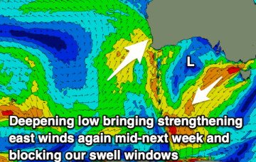
Average, windy weekend, better early next week
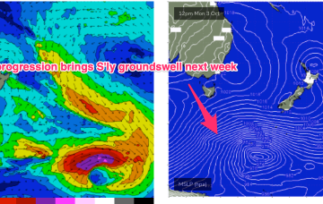
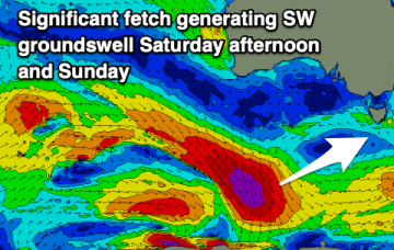
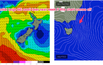
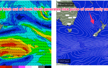
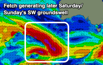
Windy and with a small swell for the weekend. Better early next week with a new westerly swell along with offshore winds.
No great change to the weekend f/cast. Wind and swell regimens will be dominated by the low in the Tasman, which is now retreating towards the North Island with a large (1037hPa) high south of Tasmania. Pressure gradients do slowly ease over the weekend as the high relaxes over warm Tasman sea waters and the low sets up near the North Island.
A run of favourable winds and conditions over the coming period for the South Coast until mid-next week.
We've got a run of east winds this period though Sunday morning looks to be the cleanest west of Melbourne with a new groundswell.
We'll see poor winds and conditions through tomorrow, improving from Friday but cleanest on the weekend.
There’s still some model divergence to deal with but some model runs show gales developing in close proximity to the NE Tas coast. Under this scenario we will be looking at a serious NE swell event, for late next week.
We've got smaller swells on the cards for the coming period but with generally favourable winds in the mornings.
We are now on the cusp of a low pressure event as a complex inland trough of low pressure forms a new low off the Central NSW Coast, backed by an advancing strong high pressure cell.
We'll see the fun run of waves on the Mid Coast fading through the end of the week, with onshore winds tending lighter and more offshore for the South Coast through the weekend.