Autumn finally kicking into gear
Monday, 20 May 2024
Autumn finally kicking into gear
Monday, 20 May 2024
This week looks fun but next week looks better with a good run of swell and favourable winds.
This week looks fun but next week looks better with a good run of swell and favourable winds.
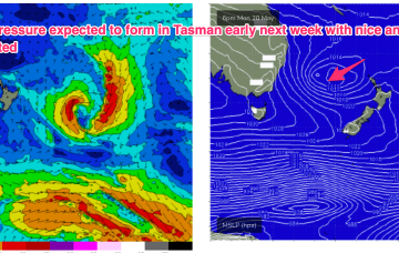
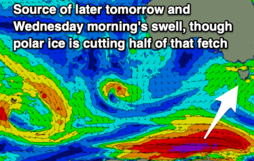
The remnants of the weekends low pressure trough are currently being reinforced by a another cold front and expected to form a broad low pressure system in the Tasman in the short term which will supply some fun waves this week with an easing trend into the weekend
The coming period is a little flukier but there should be windows across both regions, with the exposed breaks firing up next week.
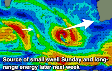
A trough in the jet stream and low in the Tasman will disrupt this flow and we’ll see a few tiny days as a result early next week.
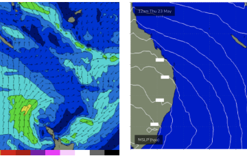
A front passing Tasmania today triggers an angled trough of low pressure off the NSW Coast o/night which quickly moves out into the Tasman Sea. The front will generate strong S swells for Sat with fresh SW winds.
The coming period remains very active with swell aplenty.
Big and windy for Sun with fresh to strong SW-S winds early, tending strong S’ly all day.
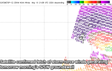
An angled trough of low pressure forms off the NSW Coast o/night and quickly moves out into the Tasman Sea. Compared to Wed’s notes windspeeds look a smidge weaker, but the fetch forms a better aligned SE arm around the trough line through Sat.
There's nothing to really point out this period with funky swells and funky winds.
The wind outlook will turn less reliable from this afternoon with fun swell pulses for the South Coast.