Nothing great expected until next week 
Wednesday, 27 August 2025
Nothing great expected until next week
Wednesday, 27 August 2025
I’m still not holding my breath for the next few days.
I’m still not holding my breath for the next few days.
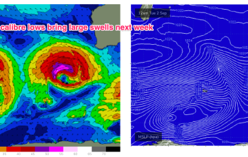
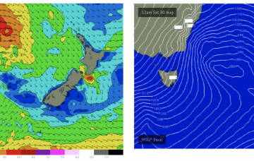
The system intensifies to storm forces status Sun/Mon as it tracks NE towards the SW corner, generating large swells for Wed.
We’ve got a powerful winter swell event bearing down on the coast, with very large waves expected to develop Friday.
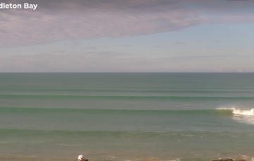
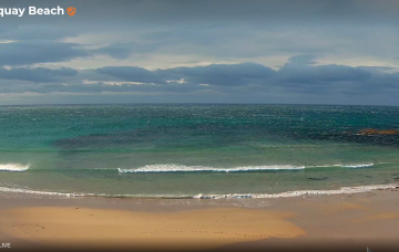
Let’s not be distracted by the weekend’s main event - there are some OK waves on the way for Thursday.
The initial SE surge is confined to more northerly waters but as the week progresses SE winds should extend though more of the Coral Sea and generate rideable waves for CQ.
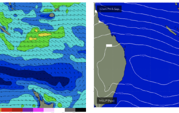
A powerful front and low forming near Tasmania drives gales up from the Bight over the inland of the SE of the continent, then re-enters the Tasman as SW gales to severe gales early Sat morning.
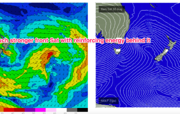
Winds shift W’ly as the initial frontal system sweeps across NSW tomorrow, with a stronger front and low moving up over NSW and then entering the Tasman with a vengeance into the weekend. We’ve still got some E’ly swell inbound from a retreating low which fired up as it approached the North Island.
Winds shift W’ly as the initial frontal system sweeps across NSW tomorrow, with a stronger front and low moving up over NSW and then entering the Tasman with a vengeance into the weekend.
We’re entering a windy wintry pattern for the next week or so, but the surf outlook isn't great for the South Arm.
A new polar low will develop at very low latitudes on Wednesday, before rocketing up to the north-east, wrapping around the primary mid-latitude low on Thursday, reaching the SA coast sometime on Friday with gale force W/NW tending SW winds.