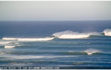
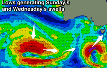
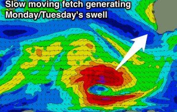
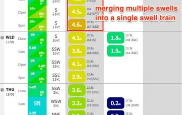
Large period of S/SE swells, biggest Wednesday, best Thursday
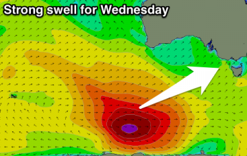
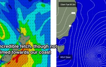
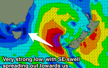
So, there’s no shortage of size this week in a synoptic environment that feels more like June than January.
Lingering onshore winds and an easing S/SW swell tomorrow, better Wednesday with a new swell and morning offshore. Fading surf from the afternoon into Thursday and further into the weekend.
Large reinforcing SW swell for tomorrow morning with offshore winds all day, easing through the rest of the week with average winds.
Average tomorrow with an easterly breeze and small swell early, building later in the day but onshore, with a peak in good swell Wednesday. Good winds for both coasts but pumping Thursday as the swell eases with all day offshores down South. Poor weekend.
Small tomorrow morning ahead of a late increase in strong new swell, peaking Wednesday with a morning E/NE breeze. Easing swell Thursday but clean across most locations, fading Friday and into the weekend.
In fact, we’re looking at around five or six individual swell sources all related to the same broader parent system. As such it’s hard to pin down the precise trends as we’ll see many overlapping swell trains throughout the course of the week.
Next week’s looking very complex. As discussed on Wednesday, we have a deep Tasman Low expected to develop though the specifics have moved around a little.
Clean easing mix of E/SE and NE swells tomorrow morning in southern corners. S'ly swell pulses from Sunday through Tuesday, with hopefully a better SE groundswell pulse Wednesday/Thursday.
Easing onshore surf tomorrow, with a good new SW swell for Sunday and clean. Average waves Monday and Tuesday ahead of a good new W/SW swell Wednesday.
Fun waves at swell magnets across the South West tomorrow morning. Great swell for Monday and Tuesday with favourable winds.