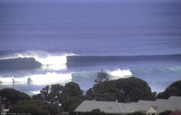
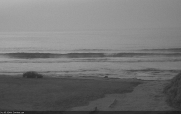
Poor outlook for SE Qld, but fun prospects for Northern NSW
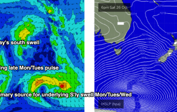
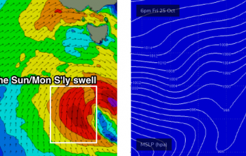
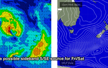
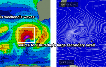
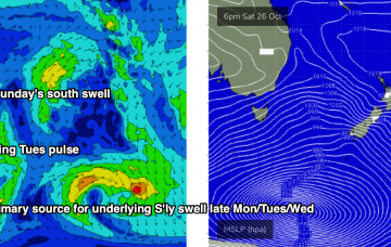
There's a multitude of swells on the horizon, each of which looks pretty flukey though. More in the Forecaster Notes.
Sunday’s south swell will be related to a small fetch associated a much broader, more complex series of polar lows and fronts further south. More in the Forecaster Notes.
More large swells on the way, bigger than the last one! More in the Forecaster Notes.
Small residual S’ly swells will persist for the next few days though no major size is expected. There is some promise over the coming days though, from the north and south. More in the Forecaster Notes.
A strong passage of fronts and lows across Tasmania will maintain westerly quadrant gales from Friday through Monday or even Tuesday. There is some good surf on the way though. More in the Forecaster Notes.
OK, we’ve got three days of northerlies ahead (potentially four for those of you north of Ballina), with only one window of light winds to capitalise on. More in the Forecaster Notes.
Another series of poorly aligned fronts are approaching the southern tip of New Zealand from the south-west, and although the swell they’re generating will be aimed into the eastern Tasman Sea and South Pacific, we’ll see a small spread back into Southern NSW. More in the Forecaster Notes.
Today will be spent periodically checking the buoys to monitoring the leading edge of an approaching groundswell that delivered clean 10ft+ sets across the Margaret River coast yesterday. More in the Forecaster Notes.
Today will be spent periodically checking the buoys for leading edge signs of an approaching groundswell that delivered clean 10ft+ sets across the Margaret River coast yesterday. More in the Forecaster Notes.
So, we’re just playing the waiting game at the moment. More in the Forecaster Notes.