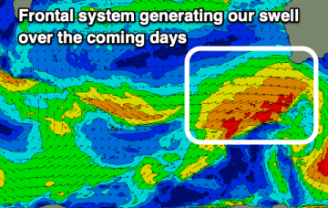
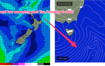
Cold fronts ahead bring S swells and cooler conditions
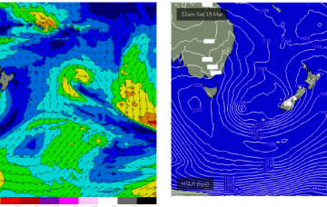
In addition a NE fetch is located off the NSW South Coast, generating E/NE to NE swell.
A broad, angular area of low pressure in the Northern Coral Sea, extending southwards is maintaining good windspeeds in the tradewind fetch at the moment and that is leading to surf punching slightly above it’s weight.
Both these fetches are going to supply fun sized mid period swells going into the weekend with a front and low expected in the Tasman Sea over the weekend.
Nothing too major this period and with dicey winds for the most part. A slower period than we've had the past few weeks.
A tricky forecast with improving and varying winds through most mornings along with some good swell.
Bit of an upgrade now for Sunday as a parent low tracks into the Tasman Friday with a much healthier fetch fetch of S to SSW winds extending through the lower Tasman.
We've got a fun swell to finish off the week along with favourable winds, improving across the South Coast Saturday.
Good conditions are expected for the most part on the beaches with fun pulses of swell, a little down on Monday's expected size which is a plus.
Average winds over the coming days with a weak swell, better on the weekend.
That SE fetch now dips away from Tas on Wed, with an E/NE fetch off the south side of the high aimed spat the East Coast.