Plenty of swell to come as winds freshen
Monday, 7 November 2022
Plenty of swell to come as winds freshen
Monday, 7 November 2022
An active Southern Ocean storm track will deliver plenty of swell for us this period and beyond.
An active Southern Ocean storm track will deliver plenty of swell for us this period and beyond.
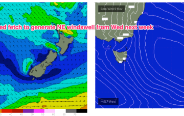
We’re looking at a fairly static, summer-style blocking pattern this week with semi-stationary high pressure in the Tasman, and a ridge up along the Eastern seaboard with SE winds in the North, E/NE to NE winds from the Mid North Coast down to Southern NSW. A long trough line extending from the Solomon Islands to the North Island spins off some small low pressure areas this week. Although not quite as spectacular as model runs suggested last week we’re still in for some fun E swell this week with a juicier pulse expected late this weekend.
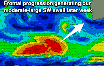
Easing surf tomorrow with clean conditions through the morning ahead of developing onshore winds and a moderate-large SW swell later week. Conditions will improve slowly on the weekend.
We’re looking at a fairly static, summer-style blocking pattern this week with semi-stationary high pressure in the Tasman, and a ridge up along the Eastern seaboard with SE winds in the North, E/NE to NE winds from the Mid North Coast down to Southern NSW. A long trough line extending from the Solomon Islands to the North Island spins off some small low pressure areas this week. Although not quite as spectacular as model runs suggested last week we’re still in for some fun E swell this week with a juicier pulse expected late this weekend.
Favourable winds and surf for November down South with the mornings fairing the best.
Small to moderate sized swells and favourable winds will make for a feast across the beaches this week.
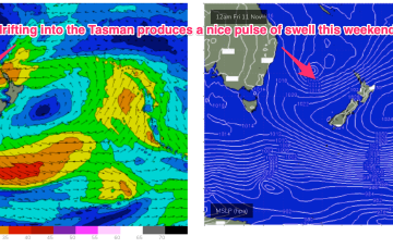
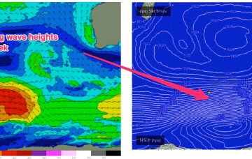
This will be generated by a polar low transiting past Heard Island staying below 50S as it tracks through the Southern Ocean Sat/Sun, weakening through Mon under current modelling.
We’ve got some more great waves due over the weekend.
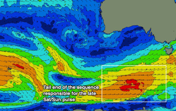
Today’s strong swell is expected to ease a touch into Saturday morning, ahead of a renewal of long period energy into the afternoon, generated by a strong fetch at the tail end of our recent Southern Ocean conveyor belt.
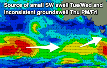
No great change to the weekend f/cast. A last pulse of longer period S swell generated by a final frontal progression and parent polar low transiting the Southern Ocean extends through Sat after filling in later Fri.