Easing S swells with a nice run of E/NE swell ahead

freeride76

Easing S swells with a nice run of E/NE swell ahead

freeride76

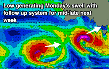
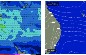
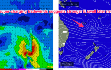
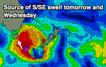
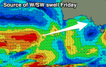
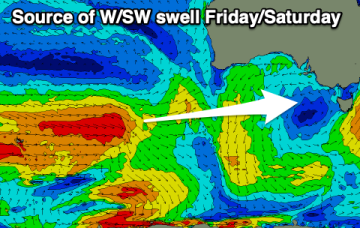
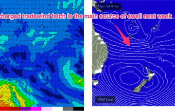
Classic late Summer pattern next week with high pressure straddling New Zealand, a monsoon trough strung across Northern Australia extending into the South Pacific and a long, broad tradewind fetch between the two broadscale atmospheric features. The fetch is so broad and long that we’ll see quite an energetic E/NE swell propagate down the NSW Coast. 

Sizey S swells en route before another long play trade-swell event

freeride76

Sizey S swells en route before another long play trade-swell event

freeride76

Current ASCAT (satellite windspeed) passes show a long fetch of severe gales in the southern swell window and wave buoys are all in an aggressive upwards curve as strong S swells build along the Southern NSW Coastline. We’ll see strong pulses of swell from this system until Thurs with easing leftovers until the end of the working week. To the north an extended trade-wind fetch is setting up through the week with another long playing E’ly swell event from that pattern, favouring the sub-tropics for size.