Tricky week of winds, best late week
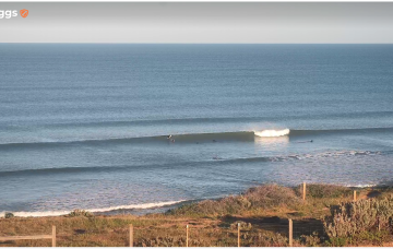
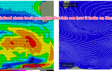
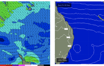
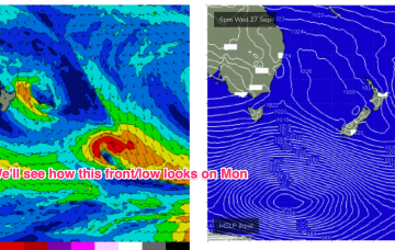
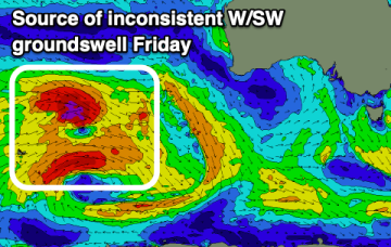
Troughy weather will bring tricky and varying winds with small surf over the coming days, better later week.
We’ve got a couple of small swells expected to impact the region over the weekend but they’re too small in size and west in direction to have a positive impact on the South Arm.
Overall, there’s no major change to the weekend outlook, with easing swell from today expected to merge with two small new swells from distant sources.
Into next week and a series of rolling disturbances across the Central Indian Ocean will provide multiple over-lapping swell trains with moderate sized swells in the 4-6ft range.
High pressure has bought a strong SE surge now establishing a strong ridge up the CQ coast and a developing SE swell. That will see see fun waves develop overnight and hold through the weekend under mod/fresh SE winds.
Into next week and no major swell sources on the radar. High pressure moves NE into the Tasman with as N’ly fetch off the NSW S Coast likely to generate some small NE windswell Mon.
A tradewind band thickens up in the South Pacific over the weekend and tilts more E/NE as winds feed into a long trough. That should see E'ly swell bump up a notch into Tues and Wed.
Not a great deal of action on the radar for next week but enough swell energy from various sources to get a surf most days. High pressure elongates and drifts NE into the Tasman with a light NW- N’ly flow expected for Mon morning and a small mixed bag of leftover S and E/NE swell filtering down from the tropics.
We’re on track for reduced storminess in the short/medium term with the very active late season Indian Ocean storm track starting to settle down a few notches (still active though) and some better quality windows of light or offshore winds on track for SWWA.