Plenty of surf from the south, south-east and east, right across the forecast period

South-east Queensland and Northern NSW Surf Forecast by Ben Matson (issued Friday 8th July)
Best Days: Sat: Good surf across the Northern NSW points with a combo of S/SE and SE swells, and S'ly winds. Only small in SE Qld. Sun: Light winds across all coasts and a moderate mix of S/SE and SE swells, ahead of a late pulse of E/SE swell. Mon: early light winds and strong easing SE swells. Wed: decent long range E'ly swell with offshore winds. Easing from Thursday afternoon. Thurs/Fri/Sat: strong building S'ly swell, could be large at south swell magnets in Northern NSW.
Recap: Tuesday started off very small at most beaches, but a new short range S’ly swell built to 4-5ft at south facing beaches south of Byron into the afternoon. Wave heights were much smaller north of Byron, and tiny across SE Qld. Today, we’ve seen a mix of easing short range S’ly swell and building long period S’ly groundswell, with wave heights maintaining 4-5ft at south facing beaches in Northern NSW, and very small conditions persisting north of the border. Early W/SW winds have tended light and variable throughout the day in most areas, though gusty southerlies are pushing across the Mid North Coast and up to the lower Northern Rivers (gusting 26kts at Coffs Harbour, and 24kts at Yamba). This southerly direction was expected though it’s stronger than anticipated and is penetrating further north than was modelled on Wednesday.
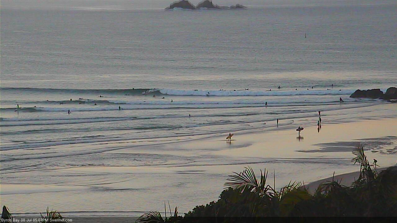
Late afternoon lines at The Pass, Byron Bay
This weekend (Saturday July 9th - Sunday July 10th)
We’ve got some great surf expected right across this weekend, with Sunday shaping up to be the pick of the weekend.
There have been several sources of new swell in various parts of our swell window for the last few days, and a couple of them are starting to approach the mainland.
Right now we’re seeing some nice long period southerly groundswell, across Northern NSW and this will continue through into Saturday. Additionally, a really nice SE fetch developed mid-way between Southern NSW and New Zealand on Thursday, and this swell will fill into the Northern NSW coast on Saturday.
However the latest model guidance has strengthened a southerly fetch just off the Northern NSW coast tonight and into tomorrow. This will generate some short range energy for exposed beaches and will delineate the long period lines somewhat.
The upshot of this mix is that we’re looking at strong sets in the 4-6ft range at south facing beaches, however they’ll be somewhat wind affected by a moderate to fresh southerly wind (the same breeze pushing up the coast now). These winds should veer more SW early morning but a southerly trend is likely at exposed Northern NSW regions from about mid-morning onwards.
However the points and other protected spots should do well under this breeze; they’ll be smaller obviously but we should see remaining open beaches holding around 3-4ft with smaller 2ft surf at sheltered southern corners. Wave heights will probably ease a little during the day.
Across SE Qld, the swell direction combo really won’t favour a lot of size away from the south swell magnets. We’ll see better conditions with mainly SW winds all day however most locations (open beaches, outer points) are likely to see 1-2ft surf, with better 2-3ft sets at exposed northern ends and south swell magnets. Wave heights are now expected to ease slightly throughout the day.
Sunday is shaping up to deliver some really good waves. The brief ridge responsible for Saturday’s southerly flow will weaken, causing winds to become light and variable across all coasts, and Saturday's combo of S’ly and SE swells should hold steady with 4-5ft sets at south facing beaches in Northern NSW (smaller elsewhere), with 2ft+ surf at south facing beaches in SE Qld and 1-2ft surf across remaining beaches.
However, a new long period E/SE swell is expected to arrive in Northern NSW mid-afternoon, generated by a strong fetch developing west of Cook Strait (the body of water separating New Zealand’s North and South Islands) later today.
The latest model runs now have this fetch aimed a little more favourably towards Southern NSW than Northern NSW, but I still think we’ll see some great waves as a result - though surf size in SE Qld has been pulled back a little as a result of the minor alignment adjustment.
Also, the timing on this next pulse is currently unclear - it’s unlikely we’ll see anything before lunch - the Mid North Coast is more likely to see the first signs of energy (mid afternoon) with the North Coast likely to lag a couple of hours behind, and SE Qld a couple of hours behind that.
At this stage I think we’re looking at some very late sets pushing the 5-6ft range across exposed beaches in Northern NSW, south of Byron, and if we’re lucky enough to see the new swell across SE Qld, surf size should peak at maybe 3ft+ at exposed spots just before dusk. However most of the day will be much smaller across the Gold and Sunshine Coasts.
Next week (Monday July 11th onwards)
If there’s a positive about Sunday’s late arrival, it’s that this holds out a better chance of the swell persisting into Monday morning.
Early morning should offer great conditions with light variable winds across all regions; we’ll see freshening N’ly tending NW winds through the afternoon, probably without much strength north of Yamba but there’s a chance it’ll get a little fresh and gusty across the Mid North Coast.
So, we're looking at wave heights around 4-6ft at exposed Northern NSW beaches early Monday, with a rapid easing to about 3ft during the day. Across SE Qld, open beaches and outer points should see early 2-3ft+ sets, easing to 1-2ft during the day.
It’s interesting to see that the models are calling much higher surf than this, with no easing trend across SE Qld, including from Saturday through Monday. I’m not sure for the reasoning behind this but I just can’t see the surf holding at the same size all weekend (and early next week) north of the border. It’ll be interesting to see what happens though.
Tuesday will be in between swells, with smaller residual energy around 1-2ft across SE Qld and up to 3ft across Northern NSW. Freshening pre-frontal NW winds will keep the open beaches nice and clean.
The low responsible for the Sun/Mon swell will then migrate north of New Zealand on Sunday, setting up a new E/SE fetch within our swell window. This looks much better now than last Wednesday’s model runs suggested, which has increased the surf potential for next Wednesday. There’s an outside chance for late Tuesday to see some new energy but I’m more convinced that Wednesday morning will deliver the next round of energy.
This E/SE swell won’t be especially large nor very consistent but we should be looking at 3ft+ sets across the open beaches of Northern NSW and SE Qld, maybe a little smaller south of Coffs. Surface conditions are looking great with moderate W/SW winds in most areas.
This low north of New Zealand will slowly retreat eastwards early/mid week, and rotate clockwise, away from our swell window, which reduces its swell potential. This should still see inconsistent 3ft sets about the open beaches on Thursday morning but a downwards trend is expected throughout the day. And we’re also at risk of southerly winds developing on Thursday in response to a series of strong fronts through the lower Tasman Sea.
The next major system for NSW surfers will be associated with a powerful cold outbreak pushing across the SE corner of the country early next week.
Initially, the fetch existing eastern Bass Strait - our funkiest south swell window - will be very west in direction. We need at least a smidge of south in the fetch before our south swell possibilities start to open up, and right now it doesn’t look like that will happen until the early hours of Wednesday morning.
Therefore, the next likely kick in south swell across Northern NSW will probably be on Thursday. Then, as the associated cold front rounds the Tasmanian corner and tracks through the lower Tasman Sea, it’ll generate a proper southerly groundswell and this will be our primary swell source for Friday and Saturday.
Estimating likely surf size is difficult at this early state but I wouldn’t be surprised if Thursday reaches 4-6ft at south facing beaches south of Byron, with bigger sets in the 6-8ft range possible through Friday and Saturday.
Unfortunately, the unfavourable direction will significantly cap surf size throughout SE Qld, away from the swell magnets. So keep your expectations in check north of the border.
I’ll take a closer look at all of this on Monday; otherwise stay tuned to the comments below as I’ll update with relevant observations over the weekend regarding the impending SE and E/SE swells.
Hope you get some great waves!
Comments
Hey Ben, Love the sound of Sunday in SE QLD, I hope you're on the mark, I kinda reckon it's gonna pulse with combo swell and push 4-5 ft with s winds at my local. I guess better to under estimate to give us a surprise. Happy with anything over 3 ft and limited crowds. Cheers legend
Thanks mate! Fingers crossed.
Strong lines on the Tweed this morning, nice conditions too. Seems to be about 3-4ft here.
Pretty small on the Sunny Coast this morning, even at the magnets. Hope tomorrow brings more love.
What a weird year.
More than a month after the Black Nor-easter swell of the decade and it looks like not a single grain of sand has been added to the destroyed point break banks south of Cape Byron. The marquee regional Pointbreak is a shadow of it's real self: just a burger breaking on the rocks.
That leaves a small number of B and C grade spots, funky and mediocre, with occassional windows of small fun surf and easily swamped by any swell bigger than 3ft to take the crowd load. With constant exhortation to head south of the border that is seeing a helluva lot of crowded mediocrity this winter.
Summer was almost unbelievable with so may high quality swells and every Point with A-grade sand; we've now got the inverse of that. TC Winston knocked those banks for 6, they slowly rebuilt to be gouged again with the Anzac day blow.
Slowly rebuilt through May to be definitively destroyed in the storm swell that preceded the June 6 day of days.
Now the rebuild looks like it will take longer than winter to make good.
Not complaining or whining. It is what it is.
But of you are thinking of heading south of the border, you should know what you are burning fuel for.
2ft d-Bah will have better shape than the crowded 4ft burgers on offer here. And will for the forseeable future.
I know what you mean Steve, it's weird on the Tweed too. Though there are good options if you look hard enough, I had a really fun surf around lunchtime today, long right handers and a workable crowd.
What Steve said.
Point has the occasional great wave but the wave:person ratio is way out. Most waves are burgers even on low.
Doing better off the medium sth swells on the open beaches at the moment but it's pretty nervy surfing those outer banks all alone.
Why Lost d,they have only tagged 29 whites.....so far.....,dont know what your worried about.......
It's a weird feeling when you watch a set barrel through an empty lineup and a stranger asks you to paddle out with them.
A couple of spots south of Byron were epic yesterday, south wind didn't come up until midday. A squall of rain came through in the evening and the southerly kicked up stronger which made the swell a little bumpy this morning but the swell muscled up so still fun. Few bomb sets came though, decent 5ft on some. Your report for Friday (Wednesday's report) was on point Ben, cheers mate.
I would post pics but I got shit for it last time.
very far from epic
agreed. the tweed coast is just a shit show. thumping shoreys or all alone on the banks 10ks out to sea. I know winston provided heaps of surf earlier in the year. But compared to last year this year has been ordinary. I mean weve had spectacular swell events this year but last year had consistent 2-3ft swells insanely good banks for all of autumn and winter and the crowds were minimal. This year has been crowded as and whats the point of getting excited for an arvo surf when the only spots within an hr of you that have a bank are dbah and caba. rant over.
I concur completely with your rant mlb88. As Ben mentioned above if you hunt around hard enough and get a little lucky there is the occasional reward, but even then tidal shifts can swallow whatever banks are working at any given time very quickly. After a shitty/busy day at work today I was keen for a quick paddle, checked a bunch of spots and crowded beachies at Caba was the best of a bad bunch.
I miss last years banks!
Cabba Has barely any sand at all these days
its the best of a bad bunch
What I don't get is that most banks on the northern beaches Sunny Coast were still ok the couple of weeks after the blacknoreaster swell.
Then we get very little swell, mostly flat and offshores. And now most banks are awful, with a few exceptions. Odd
Its just not happening lately. Never thought i would say it but starting to lose interest in surfing. Maybe time for a surf trip.
Hmmm.... Imgur doesnt want to load...... But that east swell scenario I've been waffling about looks good on ascat..... Solid 40k winds.....
Whales playing close to shore at Sunshine at lunch nice to see.
North end 3ftish. South end 1-2ftish. Fuck all banks about.
Surfed the same spot on the Tweed as yesterday, today, around the same time too (12-2pm). And it was a little bigger and way stronger. Couple of sets pushing 4-5ft at times, with more SE in the direction too. Scored some unreal waves. Two surfs his weekend, both very satisfying.
Checked again an hour or two before dusk and it was a little bigger again, not quite 6ft but not too far off. Buoy data has shot up since around then and it's a really noisy swell this evening.. Would have to be easy 6ft+ at exposed Northern NSW spots right now. Will be interesting to see what happens in the morning.
Couple of sets pushing 3ft at Snapper.
Looking quite good out east now..