Great Sunday, trickier outlook next week
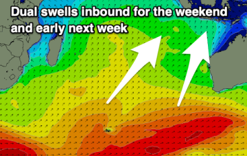
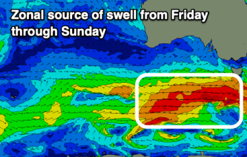
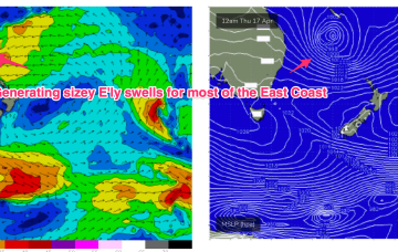
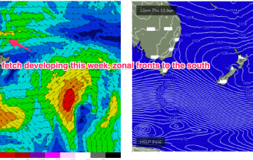
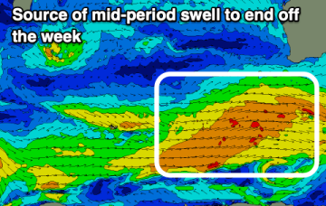
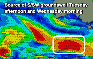
A good swell is due tomorrow but with tricky winds, better into Sunday with smaller swell pulses and favourable winds for the beaches next week.
The coming days and weekend will be most active, slower from mid-next week.
High pressure is moving into the Tasman, strengthening as it drifts towards New Zealand, where it is expected to become a dominant “flat topped” feature, reinforced by subsequent high pressure moving into the Tasman. We’ll see a long E’ly fetch develop through the South Pacific slot through the end of this week into the Coral Sea, enhanced by a trough of low pressure near New Caledonia which is attached to a still active monsoon trough.
We’ll see a long E’ly fetch develop through the South Pacific slot through the end of this week, enhanced by a trough of low pressure near New Caledonia which is attached to a still active monsoon trough. Swells from this source may eventually reach NETas later next week.
A large mid-period swell with offshore winds is due into the end of the week, with a standout day for the weekend.
High pressure is moving into the Tasman, strengthening as it drifts towards New Zealand, where it is expected to become a dominant “flat topped” feature, reinforced by subsequent high pressure moving into the Tasman. We’ll see a long E’ly fetch develop through the South Pacific slot through the end of this week, enhanced by a trough of low pressure near New Caledonia which is attached to a still active monsoon trough.
The coming outlook is great for the South Coast though the Mid Coast should offer a day or two of fun swell as well.
High pressure is moving into the Tasman, strengthening as it drifts towards New Zealand, where it is expected to become a dominant “flat topped” feature, reinforced by subsequent high pressure moving into the Tasman. We’ll see a long E’ly fetch develop through the South Pacific slot through the end of this week, enhanced by a trough of low pressure near New Caledonia which is attached to a still active monsoon trough.
The coming period provides more options to the east on the backside of the weekend's swell activity.