Good swells, spoilt by onshore winds
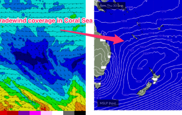
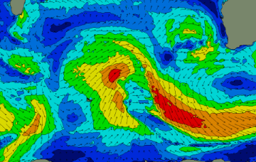
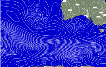
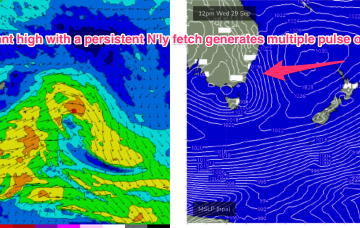
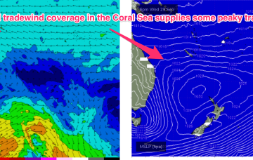
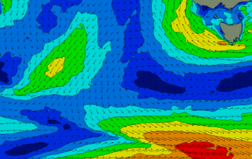
There's plenty of swell on the way for the coming week but a deepening and slow moving mid-latitude low will set up across us, bringing onshore winds.
The high generates a broad coverage of E’ly tradewinds in the Southern and Eastern Coral Sea and then a more focused fetch of ENE winds as it becomes concentrated into an offshore trough.
Not much in the way of quality for the coming period with mid-latitude lows and lower quality swells.
This will see a regime of northerly winds adjacent to the coast and an unstable atmosphere on the coast and inland. NE to N winds feeding into the trough will see swell from that direction become dominant with a peak in size expected mid-week.
The coming forecast period is more miss than hit with dicey winds and nothing like the swells we've seen over the past month or so. A spring outlook with a bit of weather and wind.
Make the most of the clean conditions and fun sized surf on the beaches before winds go funky into the end of the week. We've got some good swell pulses due though and there'll be windows for both regions. Check back Wednesday for more clarity.
A deep low just to the SW of Tasmania with a strong front attached is expected to transit into the Tasman sea through tomorrow with gales adjacent to Tasmania generating a steep increase in S swell through the a’noon.
Typically tradewind swells improve in quality as the fetch “matures” and wavelengths draw out. This tendency will be mitigated by freshening N’lies but does offer good prospects for backbeaches throughout the entire region.
Another long period S swell pulse is expected in tomorrow morning, albeit a notch smaller than today, but you’ll have to get your skates on before the S’ly change hits.
Nothing special tomorrow even with the sizey swell due to the local winds, much better from Sunday.