Extended period of unstable conditions, N/NW winds and small windswells

South East Queensland and Northern New South Wales Surf Forecast by Ben Matson (issued Friday 29th January)
Best Days: No great days due to funky winds and small flukey windswells. There'll probably be brief windows of opportunity but nothing worth getting excited about.
Recap: Strong renewal of E’ly swell on Thursday, reaching 4-5ft in Northern NSW and 3-4ft+ across SE Qld. Early light winds created clean conditions in some regions though they remained northerly from Wednesday night into the morning at some spots (i.e. Ballina, Moreton Island), never swinging offshore and consequently maintaining bumpy conditions. Freshening northerly winds then created bumpy conditions into the afternoon. Today we’ve seen a rapid drop in size from the east, and a freshening north-west tending northerly breeze as a complex trough moves across the region. Winds have been lighter and more variable in southern locations.
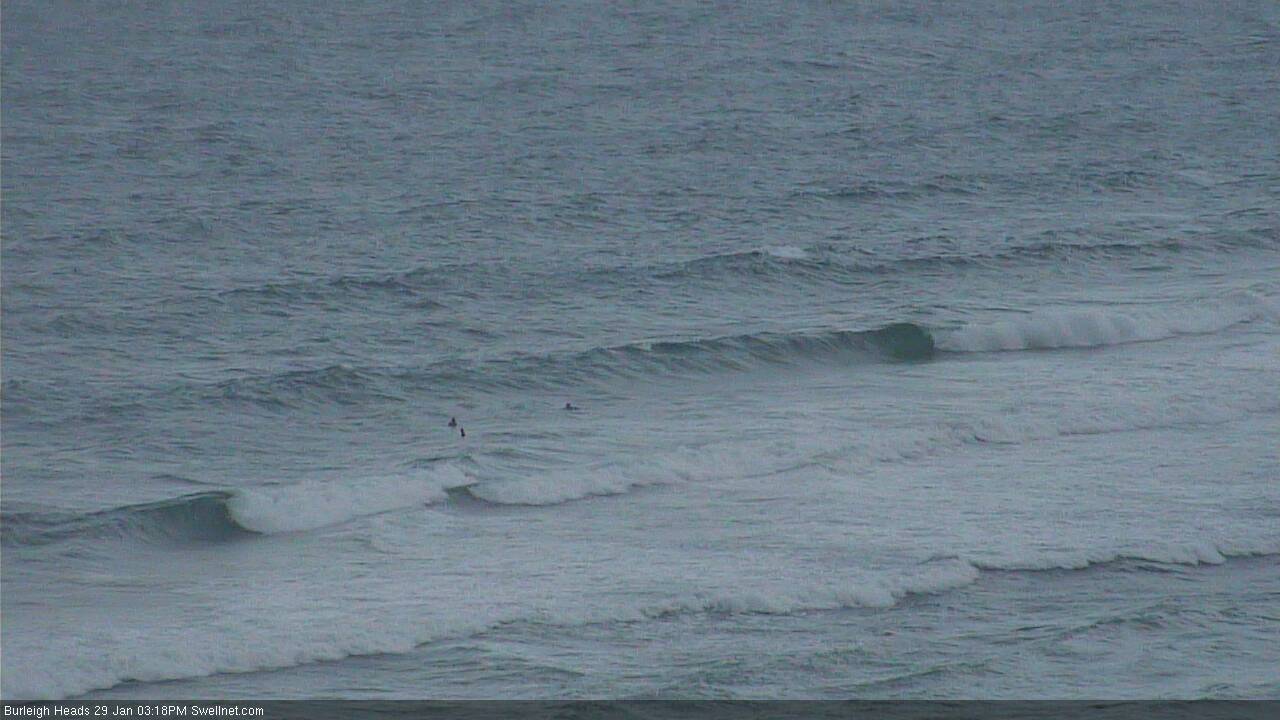
Deceptive Burleigh this afternoon
This weekend (Jan 30th - 31st)
No major surf is expected for the weekend.
Our easterly swell source is continuing to abate and by Saturday morning it’ll be rather small across most coasts, barely an inconsistent 1-2ft at best, maybe some stray 2ft+ sets at reliable swell magnets but falling throughout the day. This swell will be almost completely gone by Sunday.
The broad coastal trough occupying our region will create tricky winds and weather too.
In general, the northern flank of this trough will lie across South-east Queensland, bringing moderate to fresh N/NW winds at times. They’ll occasionally veer NW (good) and N’ly (not good), but without any appreciable swell it’s really not getting too excited about any surf prospects.
In Wednesday’s notes I mentioned that we would potentially see some short range N’ly swell from this source, and while it’s still technically possible, I am concerned that the fluctuating nature of the winds - pulsing with passing thunderstorms, then easing for brief periods - may not conducive to any degree of reliable swell generation.
As such I am slightly lowering my expectations from this source. Exposed north facing beaches north of Byron may see occasional 2ft+ sets at times, building from a small base on Saturday morning towards a peak in the afternoon, then fluctuating in and around this size range throughout Sunday. Obviously, those beaches picking up any surf will also be bumpy under the accompanying winds, but the key to finding the best waves under these circumstances is to look for the thundery periods, as this is when we often see winds momentarily swing offshore (don’t surf if there is lightning about though!). That’s about the best you can hope for this weekend.
South of Byron, the swell potential from this will be a little more limited, however winds should be lighter and more variable, so conditions should be more manageable. Aim for an early surf Saturday morning to capitalise on the leftover E’ly swell, but peg your expectations very low. This is not a weekend with any great chance of a decent wave.
Next week (Feb 1st onwards)
The coastal trough is expected to linger across the region for the first half of next week. As such, much of what I described above will probably continue to play out from Monday thru’ Thursday morning - tricky, variable winds, and small short range N’ly windswell, biggest at north facing beaches north of Byron. There's really not much point going into amy more detail than that because (1) the small synoptic features showing in the charts will probably move around over the coming days, and (2) the kinds of surf they may potentially generate will be short lived, and locally focused.
I’ll update in the notes over the weekend if anything of interest stands out.
Otherwise, it looks like we’ll see a more significant Tasman Low form off Southern NSW around Thursday, driving a strong southerly change an associated short range S’ly swell across Northern NSW later Thursday and into Friday. This has the potential to be quite a significant system (i.e. easy 6ft+ sets at south facing beaches) but probably quite windy, and also very south in direction - therefore limiting size across SE Qld. I’ll have a closer look at this on Monday.
The long term models are suggesting this broad, extended period of instability may also generate additional weather systems more favourably positioned inside our swell window towards the latter part of next week (and the following weekend), but this is a very long time away so let’s take a closer look in Monday’s updated outlook.
‘Till then, have a great weekend.
Comments
Quickest notes I've done in ages! Sometimes, I'm quietly stoked when the charts look shithouse.
Rest the paddling arms, catch up on some work, see the missus...finally...
What a great start to the year!!
Some potential funk and muck over inland Qld post 5th..... Some charts have this dogs breakfast moving towards the central Qld coast 8th onwards.... One particular model has a strengthening low Moving off the coast near fraser by the 11th, and creating some serious shit......
As the blind man says, "we'll see".......
Is that the area of low pressure gfs is showing inland Townsville around 5th,then moving off the coast on the 6th S/d?
Yeah, sort of, SM...... It's a real mess re' long term models.... Bottomline is another large area of low pressure over inland Qld, with associated troughs and the like...... Some models now have the low forming further to the south, around Coffs..... Something seems to be on the brew...
Check out 10/2/16, here
http://www.cabooltureweather.com/GFSLongRange.asp?units=C
All good things come to an end! That was an epic start to the year for sure thanks for your forecast notes Ben they were pretty dam accurate and scored me some good windows!
That picture of burleigh froths me big time i love those conditions i see no crowds occasional descent sets and the odd wall to work with! But mainly no crowds ! Great forecasting ben cheers
Yeah Glad all those grommets have to go back to School !!!
no crowds = comp @burleigh (started friday) islandman. would be nice though...
Does anyone know what's up with the Moffat heads surf cam?
Offline for some unknown reason, will get someone to look at it tomorrow. Sorry for the inconvenience.
No stress. There are no waves anyway. Thanks
Awesome work btw. Love checking your predictions.
Interesting summer.
We've shifted gears but instead of progressing into a mid-late summer pattern with tradewinds we're regressed back into a spring-like pattern with prolonged northerly episodes.
Upwelling, cold water, inshore algae. Ocean looks more like October than February.
See what happens then this trough system moves offshore. Looking better.