Average week of small surf, better next week

South Australian Forecast by Craig Brokensha (issued Monday April 28th)
Best Days: This morning, South Coast for the keen tomorrow morning and Friday morning, South Coast exposed breaks Saturday morning
Features of the Forecast (tl;dr)
- Smaller tomorrow with variable tending fresher S/SE winds
- Poor S/SE windswell Wed with strengthening SE tending S/SE winds
- Easing S/SE windswell Thu with E-E/NE tending S/SE winds
- Small mix of SW swells Fri, strongest in the PM, easing Sat
- N/NE tending E winds Fri, fresh N/NE tending weaker N/NW Sat
- Tiny Sun/Mon with fresh N/NE tending weaker N/NW winds
- Mod-large W/SW swells for next week
Recap
The South Coast was average and bumpy all weekend, though some chunky new swell into Saturday afternoon and Sunday morning provided decent conditions for some inside reforms at the Bay.
The Mid Coast was tiny Saturday ahead of a late kick in new swell, best Sunday morning as the tide ran out with slow, lumpy 2ft sets.
This morning there’s still a slow 1-2ft wave hanging in across the Mid Coast while the South Coast is cleaner and coming in at a fun 3ft.


Fun options this morning across both coasts
This week and weekend (Apr 29 - May 4)
This morning’s variable breeze on the South Coast is a temporary reprieve from a trough that moved through during the weekend, with a secondary system expected to project up and into us tomorrow.
This should see variable winds again tomorrow morning but with smaller levels of swell, back to 2ft across Middleton with tiny waves inside the gulf, followed by slowly freshening S/SE winds through the day.
High pressure will squeeze in from the west through Wednesday, shifting winds SE while strengthening. This will kick up some localised windswell that should ease into Thursday as winds ease and tend more E-E/NE through the morning.
No major size is expected with fading, peaky 2ft waves.
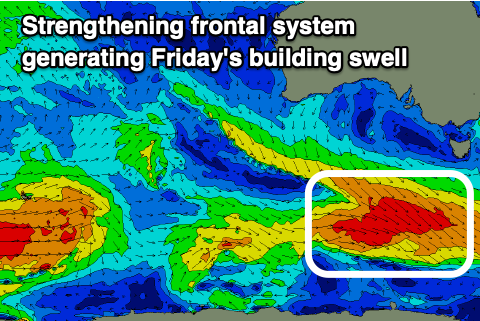
Into Friday, winds should swing more offshore from the N/NE but swell wise, there’s nothing too significant on the cards. A mix of long-range, distant SW groundswell and S/SW energy spreading off a strengthening frontal system projecting towards the polar shelf is due to build through the day. Middleton is unlikely to really top 2ft with the magnets being the go for a surf through the morning ahead of E’ly sea breezes.
The small lift in swell for Friday will fade through the weekend as winds freshen from the N/NE on Saturday (variable N/NW afternoon), with similar fresh N/NE tending weaker N/NW winds Sunday/Monday as the swell bottoms out.
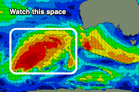
This low point in swell will be ahead of some moderate to large sized W/SW swell due into the following week, generated by a significant polar frontal progression projecting north-east towards Western Australia on the weekend, then under the Bight early next week.
The incoming energy looks to break down west of us and with this we’re set to see strong levels of W/SW swell under northerly winds ahead of a possible trough and change the following weekend. The models are still divergent in regards to the size, longevity and local winds for later next week but check back here Wednesday/Friday for a more accurate idea for what’s in store.