Cold, windy though workable

South Australian Surf Forecast by Craig Brokensha (issued Monday June 7th)
Best Days: Today South Coast, the desperate early tomorrow down South in protected spots, tomorrow afternoon Mid Coast, Mid Coast Wednesday, for beginners on the Mid Thursday
Features of the Forecast (tl;dr)
- Easing mid-period S/SW swell tomorrow with early W/NW tending strong S winds into the PM
- Mod-large W/SW swell building tomorrow, easing Wed with strong S winds, smaller Thu
- S'ly windswell Wednesday, easing Thu with fresh S/SE winds, smaller Fri with moderate E/SE winds
- Cleaner conditions over the weekend but with a small, fading swell
Recap
A good weekend of waves down South with clean conditions and 3ft of swell across Middleton Saturday, a touch smaller Sunday with options across all breaks. The Mid Coast saw bumpy 1-1.5ft waves, increasing to 1-2ft on Sunday with a new W/SW swell which has held this morning but with a strong cross-shore wind. The South Coast was clean and windy, with a new mid-period S/SW swell due to provide more size later this afternoon to 3ft to occasionally 4ft.
This week and weekend (Jun 8 - 13)
Even though windy, try and make the most of this afternoon's building S/SW swell and offshore conditions down South, as from tomorrow morning, we'll see winds swing onshore and remain so through the rest of the week, improving through the weekend but with no surf.
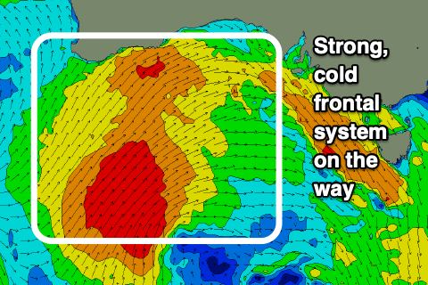
The run of poor, persistent, cold and wet conditions will be a deep pool of cold air being advected up, across the south-east of the country by a strong frontal system that's currently moving in from the west.
This cold pool will cut-off and linger across New South Wales and Victoria through the rest of the week, only weakening very slowly through the weekend before pushing towards New Zealand early next week.
What this will result is a run of poor conditions and no swell of quality (for the South Coast) as the low squeezes a blocking high to our west, bringing strong S'ly winds from tomorrow afternoon (W/NW early around Victor) persisting Wednesday, similar Thursday but tending slightly more S/SE and then E/SE into Friday morning.
 Swell wise for the Mid, we're actually due to see a moderate-large W/SW swell filling in tomorrow, afternoon, peaking into the evening, easing Wednesday.
The source of this swell is the same system bringing the cold outbreak, with it starting as a polar low, south-southwest of Western Australia but then projecting up towards the Bight while generating a fetch of strong to gale-force W/SW winds.
As the broad, low forms the fetch will move north of our swell window and turn S'ly tomorrow, with the swell building behind it.
Size wise, the Mid Coast should build to a strong 3ft+ with the incoming tidal push, easing from 2-3ft on Wednesday. The South Coast tomorrow should be around 3ft to possibly 4ft with the S/SW swell, increasing 4-5ft later in the day but with that strong S'ly wind.
Wednesday will be workable though wind affected on the Mid with the S'ly breeze, while the South Coast will see the W/SW energy easing as moderate levels of S'ly windswell take over, coming in at 3-5ft.
As winds slowly abate through the end of the week and start to improve the S'ly windswell will ease, along with the W/SW energy, but with no new groundswell to take its place.
Cleaner conditions are due Saturday and Sunday down South but with no decent swell. A background, inconsistent swell may provide 1-2ft sets Saturday across Middleton, tiny Sunday. The Mid will also be tiny to flat.
Longer term there's nothing major on the cards with the Southern Ocean remaining relatively quiet, leaving us to rely on less consistent swells from south-west of Western Australia. Therefore make the most of today and later tomorrow and Wednesday on the Mid Coast.