Large, powerful swells from multiple directions

South Australian Forecast by Craig Brokensha (issued Monday 16th September)
Best Days: Mid Coast tomorrow, South Coast Wednesday through Friday morning, protected spots South Coast Saturday morning and keen surfers Mid Coast, South Coast Sunday
Recap
Small clean waves across the South Coast Saturday, great across the swell magnets and clean but tiny on the Mid.
A new strong but inconsistent W/SW groundswell filled in yesterday, with OK conditions early down South before the onshore kicked in, 2ft on the Mid Coast and kicking to 3ft with the push of the tide into the afternoon as winds remained light.
This morning the swell has dropped back to 1-2ft on the Mid Coast while the South Coast was solid but onshore.
The Mid Coast has hovered around a tiny 1ft, only suitable for beginners.
Today’s Forecaster Notes are brought to you by Rip Curl
This week and weekend (Sep 17 - 22)
The messy and onshore swell currently breaking on the South Coast should start to ease tomorrow, but the size of the reinforcing S/SW groundswell has been downgraded a little, with dropping sets from 3ft to likely 4ft off Middleton tomorrow morning, while the Mid holds at 1-2ft on the favourable parts of the tide.
 Winds will improve but conditions will remain average across the South Coast with a moderate to fresh E/NE-NE breeze, much better on the Mid.
Wednesday will be much cleaner with a fresh and gusty N/NE offshore and further drop in swell, best across the magnets down South.
Into the afternoon a new SW groundswell should arrive, building later in the day, ahead of our larger, long-period S/SW groundswell overnight and Thursday.
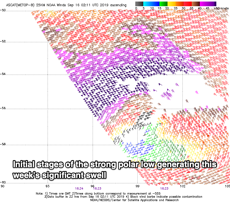
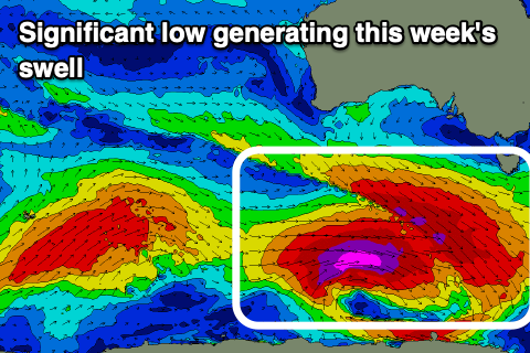
The very intense low linked to this swell has formed south-west of WA, with a great pre-frontal fetch of severe-gale NW winds followed by the better aligned and stronger polar storm-force W'ly fetch.
The low will push slowly east today and tomorrow while maintaining strength the whole time, passing under Tassie and out of our swell window tomorrow evening.
 Wednesday's late increase in SW groundswell will be linked to the pre-frontal NW fetch and we should see Middleton building to 3ft to maybe 4ft on dark, tiny on the Mid Coast.
The larger S/SW groundswell for Thursday morning should provide 5-6ft+ waves across Middleton and the Victor region through the morning, easing off through the day along with stronger N/NE winds, easing and tending N/NW late. The Mid Coast looks to remain tiny and very wind affected.
A W'ly change on Friday will bring a small increase in weak W/SW swell through the day, but be linked to a larger W/SW groundswell on Saturday.
This swell will be produced by a strong polar front pushing up and towards WA over the coming days, and then through the Bight but while weakening.
The swell should peak around 3ft on the Mid Coast Saturday, and 3-5ft across the Middleton stretch though with lingering onshore W/SW winds (likely W/NW for a period around Victor early).
Sunday looks good with a NW offshore and easing swell from Saturday, but more on this Wednesday.