All eyes are on the weekend

South Australian Forecast by Craig Brokensha (issued Wednesday 11th July)
Best Days: Possibly on dark Friday South Coast, Saturday and Sunday South Coast
Recap
Great waves all day across the South Coast with a solid sized groundswell and offshore winds. The Mid Coast was tiny and clean early, bumpy into the afternoon.
This morning there was still plenty of swell on offer across the South Coast though an onshore change moved through on day break, creating average conditions, well down on yesterday's waves. The Mid Coast was also poor with a tiny windswell.
Today’s Forecaster Notes are brought to you by Rip Curl
This week and weekend (Jul 12 - 15)
Want to receive an email when these Forecaster Notes are updated? Then log in here and update your preferences.
Today's onshore swell will ease off from later today and drop further tomorrow and it looks like we'll see lingering onshore S/SE winds at dawn, easing and tending more variable from the E through the day, creating improving conditions.
If you're keen, Middleton should be around 2ft+ with better sets at Waits and Parsons, while the Mid will be clean but tiny.
A low point in swell will be seen on Friday and it's not worth the drive from Adelaide, even for the magnets. Conditions will be clean though with a light to moderate and persistent N'ly wind.
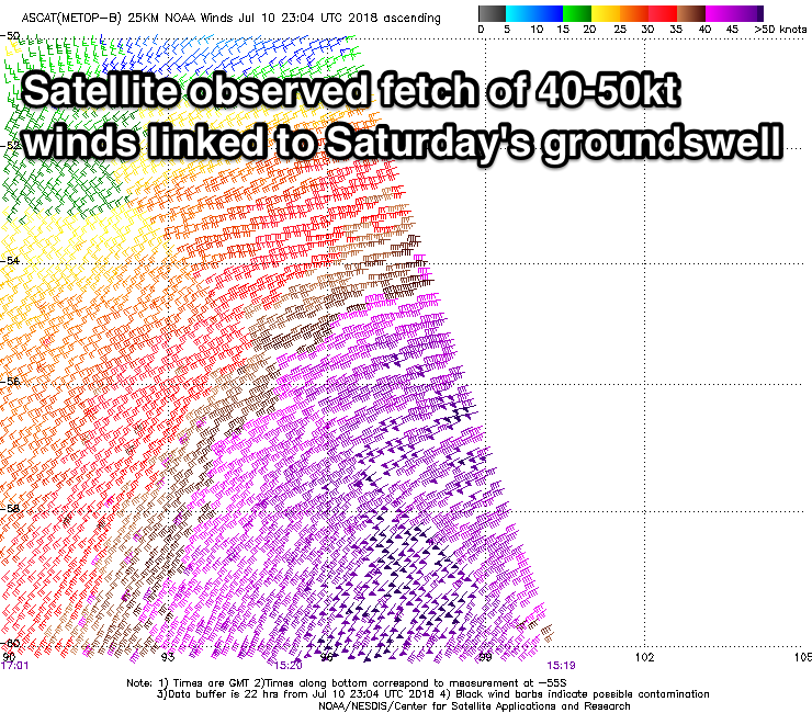 Our great weekend outlook is holding strong, with an intense polar low forming south-southwest of WA. Satellite observations have already picked up an impressive stationary fetch of severe-gale to storm-force W/SW-SW winds in our swell window and this low is now moving slowly east and will continue to generate a fetch of severe-gale W'ly winds through today, before weakening south-west of Tassie through tomorrow.
A moderate to large and long-period SW groundswell will be produced, and we should see a late increase in size Friday, so if you're around the South Coast region keep an eye out, while a peak is expected Saturday morning.
We're still expecting strong 4-5ft sets off Middleton, easing slowly through the day and down further from 2-3ft Sunday morning.
The Mid Coast looks to only offer tiny 1ft waves Saturday, with a small new W/SW swell for Sunday discussed below.
Winds look excellent for the South Coast with a moderate to fresh and persistent N/NW'ly on Saturday, similar Sunday but weaker through the morning.
Sunday's new mid-period W/SW swell on the Mid Coast will be produced by a strong mid-latitude low in the southern Indian Ocean out of our swell window, weakening but passing across WA, generating a burst of strong to near gale-force W/SW winds off their south coast.
 A fun 1-2ft of W/SW swell will be generated for the Mid, but conditions look bumpy and average with that N/NW wind.
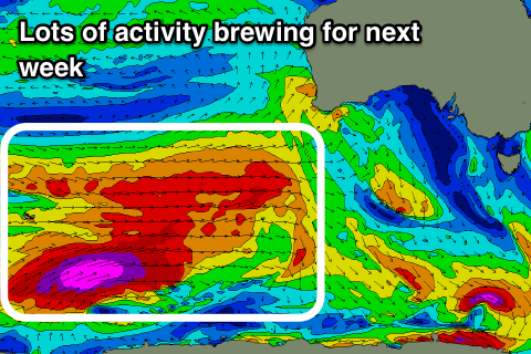
This will be the first and smallest in a series of growing W/SW swells developing for next week as a strong node of the Long Wave Trough forms in the south-east Indian Ocean and moves west across Western Australia.
With this we're set to see a series of large back to back long-period W/SW and SW groundswells from Tuesday through the end of the week.
The models still diverge on the exact structure of this winter calibre frontal progression, so check back here Friday for clearer idea on each swell pulse and the local winds.