Good S'ly swells to come, best Monday

Eastern Tasmania Surf Forecast by Craig Brokensha (issued Friday 18th November)
Sign up to Swellnet’s newsletter and receive the Eastern Tasmania Forecaster Notes and latest news sent directly to your inbox. Upon signup you'll also enter the draw to win a surf trip to P-Pass for you and a mate. It doesn’t get much easier so click HERE to sign up now.
Best Days: Later tomorrow, early and late Sunday, Monday morning, Tuesday morning all at south magnets
Recap
No change to the tiny average surf over the last couple of days.
This weekend and next week (Nov 19 - 25)
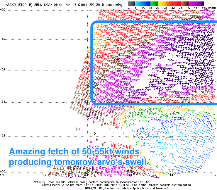 A very intense low formed south of the state last night and this morning a very impressive fetch of storm-force 50-55kt winds were recored by satellite.
While west in nature, we should see some good S'ly groundswell from this low, spreading up radially tomorrow afternoon and reaching 2-3ft across south swell magnets with offshore NW winds.
The swell will likely ease back quickly overnight, fading from 2ft tomorrow morning.
Now, the strong S'ly groundswell due Monday across the coast should be seen later Sunday.
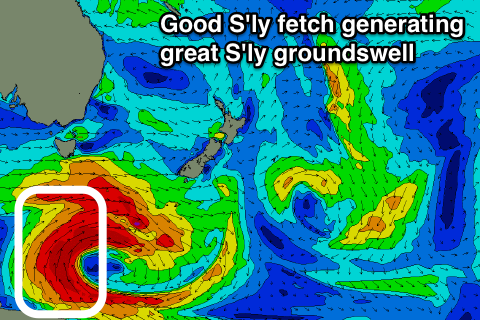
A fetch of long-lived S/SE gales wrapping around the bottom of the low generating tomorrow's swell should produce a long-period S'ly groundswell for later Sunday and Monday.
 South magnets are likely to see 2-3ft set by dark, with Monday morning revealing 3-4ft sets, if not possibly a touch bigger.
Conditions will be great as well with W/NW tending N/NW winds on Sunday and N/NW tending gusty N'ly winds Monday.
A mix of easing S'ly swell and NE windswell around 2ft are due Tuesday with morning offshores ahead of sea breezes.
The rest of the week there's nothing major of note, so make the most of the coming S'ly swell pulses. Have a great weekend!