Strong swells, large next week
Friday, 13 August 2021
Strong swells, large next week
Friday, 13 August 2021
Lots of surfing options over the coming days with varying winds and strong swells.
Lots of surfing options over the coming days with varying winds and strong swells.
There's been a local improvement to conditions on the weekend and early next week looks good until onshore winds and fronts come back late next week.
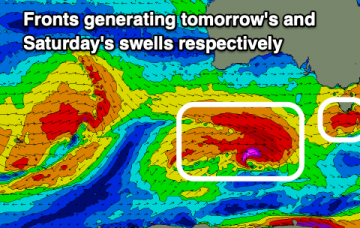
The deeper southern fetch tied to the polar low then fires up and aggressively tracks almost due north towards Tasmania with gales and severe gales extending up to almost Tasmanian latitudes later Mon.
The good run of swells and conditions will continue into the weekend though the windows on the Mid will become smaller.
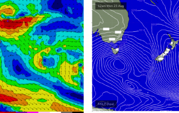
This is another impressively large and complex system, with a double headed low centre forming in the deep southern ocean around 60S and a more proximate cold front fetch expected to push NE to be adjacent to Tasmania through Monday morning.
Plenty more surf and swell to come, cleanest on the weekend and deteriorating through next week when largest.
With severe gales extending from Tasmania down to 55S and a slightly more favourable SSW tilt in the winds which then push up adjacent to SE Tasmania during Tues..
We've got some better, localised swell prospects on the cards for the coming days with lots of stronger energy from the weekend.
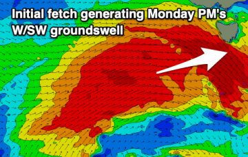
The result is a long, broad fetch of severe gales from 55S up to Tasmanian latitudes Sun , extending even further south late Sun into Mon with a more favourable SSW tilt in wind alignment in the fetch.
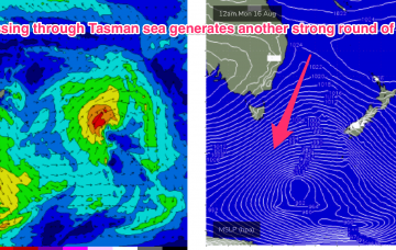
The very active Southern Ocean pattern reaches a crescendo late Sun into Mon with an intense, complex polar low which becomes slow moving as it enters the Tasman sea swell window.