Small spell for SE Qld; fun southerly pulses for Northern NSW

South-east Queensland and Northern NSW Surf Forecast by Ben Matson (issued Wed Mar 27th)
Features of the Forecast (tl;dr)
- Persistent mix of small E swell and better S swell (NNSW exclusive) on Thurs, easing Fri
- Small S swell for NNSW Sat, easing Sun AM then re-pulsing into the a'noon (maybe just MNC), gen OK conditions with light winds
- Small waves all weekend in SE Qld, OK conditions with lingering SE breeze
- Persistent S swells early next week, not much north of the border
Recap
Small, persistent east swells throughout SE Qld (2ft) for the last few days have been accompanied pulses of bigger south swells in Northern NSW (4ft), though conditions have been variable under a troughy regime that's delivered plenty of rain and periods of onshore winds.
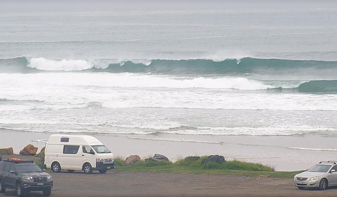
Plenty of south swell in Coffs Harbour
This week (Mar 28-29)
The trough encompassing SE Qld will move north into Thursday, allowing a general SE flow of moderate strength to become established over the region, maybe a little stronger on the Sunshine Coast but generally light throughout Northern NSW.
The swell regime for the next few days throughout SE Qld will remain small out of the east with just enough size for small runners on the semi-exposed points (open beaches are at risk of being wind affected). South swell magnets may pick up some bigger waves from pulsing southerly swells.
South of the border we'll see varying degrees of south swell both days. Southern NSW was still picking up 3-4ft sets today so we can expect a similar size range to persist at south swell magnets south of Byron into Thursday though the trend will be down and smaller surf is expected for Friday (2ft, maybe 2-3ft).
Another coastal trough currently across Southern NSW will move slowly north on Thursday (allowing for light winds throughout Northern NSW) but into Friday there's a reasonable chance that moderate S/SE breezes will develop in its wake, so expect sub-par conditions at exposed beaches. There won't be much east swell south of about Yamba either.
This weekend (Mar 30-31)
A decent frontal passage pushing up from the Southern Ocean into the lower Tasman Sea today will generate a flush of south swell, pushing across the Mid North Coast from late Friday and showing best on Saturday.
South facing beaches south of Byron should pick up decent 2-3ft sets but it'll be smaller elsewhere with a mix of short to mid range easterly swells around 1-2ft.
Winds look to freshen from the SE on Saturday, mainly throughout SE Qld as a ridge pushes into the region - but there won't be a lot of strength south of Yamab so conditions should be more manageable at open beaches along the Mid North Coast.
A slight easing in size is expected into Sunday with a general throttling of winds, they'll be light and variable throughout the MId North Coast and Northern Rivers, and light to moderate SW trending SE north from Byron across SE Qld.
During the day, the Mid North Coast may pick up a couple of long period south swells (one from the S/SW, the other from the S/SE) though I’m not confident on size prospects.
The best looking swell will have originated from a deep polar low well to the south of New Zealand today, but the fetch length is short and the low hasn’t spent a lot of time in our swell window. As such I’m keeping a lid on size expectations, hopefully we’ll see some stray 2-3ft sets at south swell magnets later in the day (overnight into the Northern Rivers) but it’s a low confidence event so don’t plan any highway miles.
SE Qld won't see much from the weekend's southerly swells so will be relying on slow peaky energy from the east both days, probably 1-2ft.
Next week (Apr 1 onwards)
A deepening low off the NE tip of New Zealand this weekend will be poorly aligned within our swell window and is not considered a swell source for our region.
Otherwise, persistent swells from the southern quadrant will provide options across Northern NSW into the start of next week (2-3ft south swell magnets), though surf size will remain smaller at beaches not open to the south, and throughout much of SE Qld. Conditions will remain clean with light winds though.
An inland trough developing across the eastern states will freshen NE winds from Thursday thru' Friday, probably just south from Yamba, however no major surf is expected from this source right now.
The inland trough may evolve into a deep low near Bass Strait so there is a chance for a solid south swell later next week but that is still quite some time away.
More on all of this in Friday's update.
Comments
How's the water temp on the Mid North fellas?
It’s warm as toast but the banks are overcooked
But yeah…I’m not actually on the mid north per se
Burp
Warm. Still boardies
Boardies. Only time I've been cold is when there was a howling southerly.
Brilliant. Cheers guys
Ben, who even cares about waves at this point, approaching 4 years of non stop rain, when will the next blue sky appear?
My only solace comes from knowing all the southern covid blowins (SCBs) have had nothing but shit weather since they moved here.
But….and let’s be honest here…youve always been a bit of a negative whinger haven’t you Sprout?
Only when it’s not 3-6foot clean uncrowded beach breaks at his local every day of the year.
Oooh someone's a little testy after my Live Webcast comment lol.
Yeah it's gonna be interesting to see how the year pans out. Broadly speaking we probably (on balance) have another 10-12 months of wet weather ahead.
Wet weather certainly makes it hard for the Climate Change Activists AKA arsonists to spread their life changing propaganda.
you think that climate change isnt real?
It's actually way more common than you think in coastal towns, at least with the stickers and graffiti you see around. People that forgot they failed school suddenly think they're actually intelligent, in possession of the 'real truth' and the scientists are wrong because (insert retarded theory here)
Mate - you do write some crap but I do hope that was a lame attempt at sarcasm
The worst east coast weather is still better then the dog shit weather on offer down south! At least when it's not flooding or on fire.
Kale slowed jacky