Good run for the South Coast

South Australian Forecast by Craig Brokensha (issued Monday March 25th)
Best Days: South Coast today and tomorrow, South Coast for the keen Wednesday morning but more so Thursday and Friday mornings, South Coast Saturday morning
Features of the Forecast (tl;dr)
- Large S/SW groundswell for this afternoon with moderate to fresh sea breezes, easing tomorrow with light, local offshore winds ahead of weak sea breezes
- Smaller Wed, Thu and Fri AM
- Light E/SE tending fresh S/SE winds Wed, E/NE Thu AM ahead of sea breezes and NE Fri AM
- Small, inconsistent mid-period SW swell for Fri PM, easing Sat AM
- Light NE tending S/SE winds Sat, variable early Sun, tending S during the morning and freshening
- Moderate + sized S/SW swell for mid-late next week but with S/SE winds
Recap
The fun run of waves on the Mid Coast faded into the weekend with tiny leftovers, onshore and generally poor across the South Coast.
Today is much better though with a light offshore wind and new mid-period SW swell, with some larger S/SW groundswell due into this afternoon. More on this below.

S/SW groundswell energy on the build later this morning
This week and weekend (Mar 26 - 31)
Today and the coming days will be the pick of the period for the South Coast with moderate to large levels of swell and favourable conditions each morning.
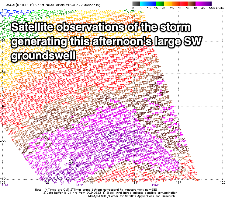
Our large S/SW groundswell for this afternoon is on track, with a strong polar low that fired up to the south-southwest of Western Australia on Friday, generating a fetch of gale to severe-gale W/SW winds through our southern swell window. There were even a couple of storm-force barbs picked up by satellite observation, and with this we should see Middleton reaching 6ft+ later today with the Mid Coast coming in at 1ft.
Sea breezes are due to be relatively weak this afternoon and evening, and with the strength of the swell, an after work/school surf is definitely worth it.
We'll see the size easing through tomorrow but early, we should still see 4-6ft waves across Middleton, easing through the day with 1ft sets on the Mid Coast.
Conditions look great again tomorrow across both regions with a light, local offshore breeze and weak afternoon see breezes while Wednesday is a touch dicey with light E/SE-SE winds down South. Not great but still doable.
A light E/NE breeze is likely into Thursday morning as the swell drops back from 2ft to possibly 3ft on the South Coast, smaller into early Friday morning and more to 2ft.

A light NE breeze will create cleaner conditions Friday morning, with some new, inconsistent mid-period SW swell due into the afternoon as sea breezes kick in.
This will be generated today and tomorrow by a healthy fetch of pre-frontal W/NW winds, south-west of Western Australia and should lift Middleton to 2ft to occasionally 3ft, easing from a similar size Saturday morning.
We've got favourable morning NE winds due again down South ahead of sea breezes, with Sunday still a chance, but lesser so with a trough bringing S'ly winds by mid-morning.
Early next week looks dicey wind and swell wise with nothing of substance due, while strengthening polar frontal activity during next week to the south of us looks to bring building levels of S/SW swell mid-late week but with S'ly winds. More on this Wednesday.