Not particularly promising for surfers

Eastern Tasmania Surf Forecast by Ben Matson (issued Wednesday 10th June)
Best Days: Sun: small easing NE swell and freshening NW tending W'ly winds.
Recap: Surf size has been generally small out of the south over the last few days.
This week (June 11 - 12)
*This week's Forecaster Notes will be a little sporadic, and sometimes brief, as Craig is on leave*
Small flukey south swells are still expected across Eastern Tasmania over the coming days though mileage will very considerably, as it’s not a reliable source. If anything, Friday has the most potential because of a slightly more favourable alignment of the source low (well south of Tasmania today), but we’ll be lucky to see much more than an inconsistent 2ft+ set at exposed northern ends. Most beaches will be much smaller.
As it is, Thursday’s less confident swell forecast will be accompanied by better winds than Friday, which is at risk of a developing E’ly breeze as a high pressure system rapidly develops east of the state.
Early morning is your best chance at seeing the best conditions but I’m just not confident there’ll be much surf around. New E’ly windswell may build later but quality will be low.
This weekend (June 13 - 14)
The high pressure system in the lower Tasman Sea will strengthen N’ly winds through Saturday as a strong front approaches from the west, generating 2-3ft of peaky NE swell by the afternoon though quality will be low under the accompanying breezy conditions.
Sunday looks better though you’ll have to be quick. As the front passes, winds will swing gusty NW then W’ly so conditions will clean up but the NE swell will quickly easy from an inconsistent 2-3ft to 1-2ft. Keep your expectations low.
Next week (June 15 onwards)
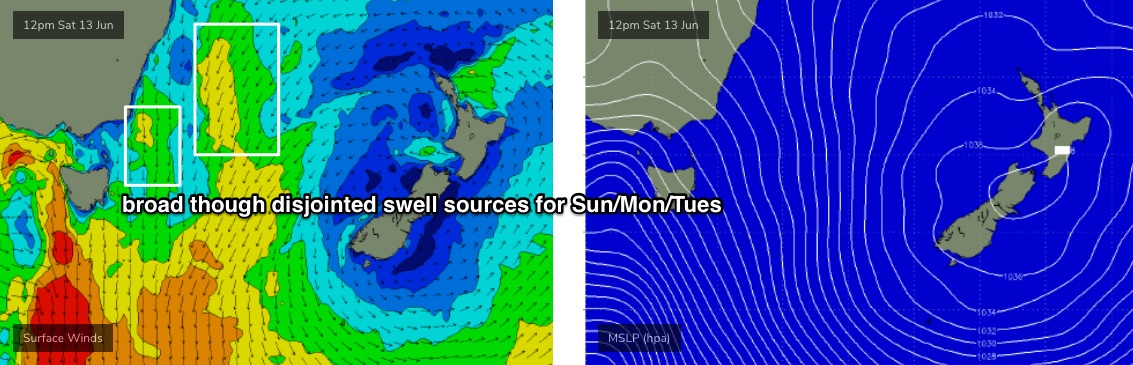
Sunday’s pre-frontal N’ly flow will extend considerable distance up into the central Tasman Sea (see below), and although not terribly strong or wide, and certainly not very consolidated, should generate small NE swells for Monday and maybe Tuesday.
Conditions will be clean though blustery under strong W/NW winds in association with an extended frontal passage across the state. They’re going to generate very large waves for SA and Victoria, however the latest model guidance suggests the storm track may in fact be a little more zonal than previously indicated, which tilts these systems away from our swell window.
It’s a cruel blow, as it means we may not see any appreciable south swell until the very end of next week or the weekend.
There’s still a chance that Eastern Tasmania will pick up small glancing south swells from the broader progression, and there’s also an outside possibility that the model guidance may swing back in our favour over the coming days - but right now we’re looking at another week ahead of small flukey swells from peripheral sources.
See you Friday.