Typical westerly pattern, with one blip from the north-east

Eastern Tasmania Surf Forecast by Ben Matson (issued Monday 8th June)
Best Days: Tues PM, Wed, Thurs AM: small inconsistent long period S'ly swell with offshore winds. Sun: small easing NE swell with offshore winds.
Recap: Surf size has been generally small out of the south over the last few days.
This week (June 9 - 12)
*This week's Forecaster Notes will be a little sporadic, and sometimes brief, as Craig is on leave*
The storm track below the continent has been quite zonal (west-east) in recent days and although vigorous, is resulting in in a lot of west in the regional swell direction. This is resulting in an average surf outlook for North-east Tasmania as the swell will lose a lot of size as it bends up and into the Eastern Tasmanian coast.
The first new swell is expected to push through later Tuesday, ahead of a stronger, longer period S’ly swell on Wednesday. Wave heights will ease temporarily into Thursday ahead of a final (from this sequence) south swell on Friday.
Wave heights will remain very small at most beaches, but south swell magnets should see occasional 2ft sets as each swell pulses. Wednesday’s and Friday’s swells look to be little bigger, owing to the larger periods (with the former) and a better storm alignment (with the latter) but I’ll be surprised if the regional south swell magnets reach much more than an inconsistent 2-3ft.
Surf conditions look best for Tuesday and Wednesday under pre-frontal W/NW winds. A shallow southerly change will push up the coast during Thursday (following early offshores), and moderate onshores are likely to develop into Friday as a high high pressure system sets up camp east of Tasmania.
So, Wednesday is probably the pick of the week. Keep your expectations low.
This weekend (June 13 - 14)
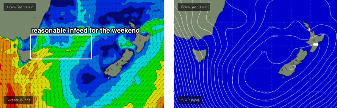
A high in the southern Tasman Sea and an approaching series of strong fronts in the Bight will strengthen NE then N’ly winds in our immediate swell window into Saturday (see below). We’ll see a building, windy swell increase across the region (bumpy 3-4ft sets by the afternoon) though most locations will become blown out.
Sunday looks better with post-frontal W/NW winds and a rapidly easing NE swell though early morning should see some 2ft+ sets at the swell magnets. You’ll have to make it early though.
Next week (June 15 onwards)
We’ve got an active long wave pattern expected for next week with an extended run of windy conditions from Saturday through until the end of next week. The storm track is expected to remain quite zonal in orientation, and relatively north in latitude, which means very small surf for quite a few days.
Let’s check back on Wednesday to see if the long term outlook is looking any better.