Nothing until Sunday and more so early next week

Eastern Tasmania Surf Forecast by Craig Brokensha (issued Wednesday 13th Jun)
Best Days: Protected spots Monday, Tuesday morning
Recap
Poor building mix of windy N/NE windswell and E'ly swell yesterday, cleaner but small and fading from 1-2ft this morning.
Today’s Forecaster Notes are brought to you by Rip Curl
This week and weekend (Jun 14 - 17)
Want to receive an email when these Forecaster Notes are updated? Then log in here and update your preferences.
Today small E'ly swell will drop back through tomorrow leaving tiny to flat waves through until Sunday, when a strong mid-latitude low slowly moves east and across us.
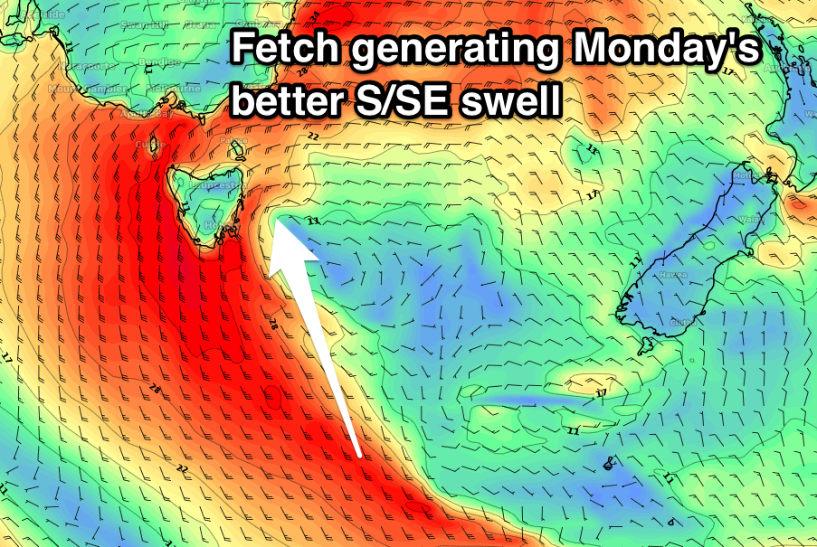 This low will be strongest when sitting west, out of our swell window generating large swell for Victoria and our west coast, but into Sunday we'll see the system slowly move east, projecting a fetch of strong S/SE winds up the coast.
The low will be weakening by then and as a result we're only likely to see a weak building S/SE windswell through Sunday with poor S'ly tending S/SE winds.
Monday will unfortunately see a continuation of poor S/SE winds as the swell eases but with more energy owing to strong S/SE winds extending further south through our swell window.
South facing locations look to ease from 4-6ft, but with those poor winds, cleaner Tuesday and easing from the 3ft range. We'll have a closer look at this Friday.