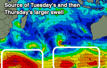
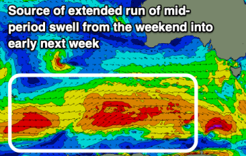
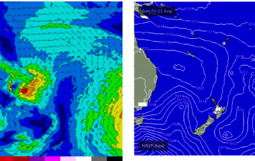
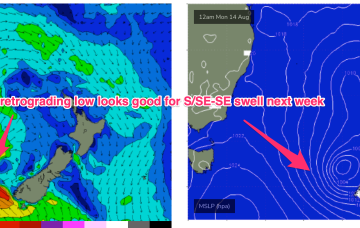
Stalled low in the Tasman brings a few pulses of S-SE swell from Sun-Wed
Friday, 11 August 2023

Stalled low in the Tasman brings a few pulses of S-SE swell from Sun-Wed
Friday, 11 August 2023
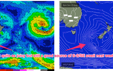
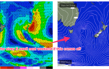
Those wind are associated with a low passing under the state and expected to stall in the Central/Eastern Tasman.