Poor winds and surf continues
Wednesday, 14 August 2024
Poor winds and surf continues
Wednesday, 14 August 2024
There's no real let up to the poor run of surf and conditions until possibly mid-late next week.
There's no real let up to the poor run of surf and conditions until possibly mid-late next week.
There's plenty more westerly energy inbound but winds won't be as favourable for the Mid Coast.
A summer style pattern is seeing tropical moisture dragged down the East coast by a trough and deep E/NE-NE flow from a large high in the Tasman, generating large stormy swells for QLD, grading smaller as you head down the NSW coast.
A summer style pattern is seeing tropical moisture dragged down the East coast by a trough and deep E/NE-NE flow from a large high in the Tasman, generating large stormy swells for QLD, grading smaller as you head down the NSW coast.
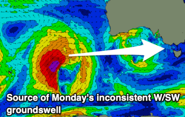
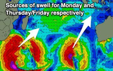
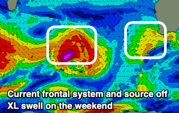
This pattern breaks down as we head into the weekend leaving a broad troughy area of low pressure in the Tasman which is expected to redevelop over the weekend and generate sizey S swells later in the weekend and early next week.
Fun swells with generally favourable winds for the exposed beaches persist.
Large, back to back pulses of swell inbound.
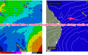
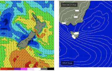
We have a strong (1033hPa) high in the Tasman, with a deep E’ly flow through the Coral Sea feeding into a coastal trough along the QLD coast. That trough is drawing down plenty of tropical moisture in the deep onshore flow, and generating sizey, stormy E’ly swells for the sub-tropics.
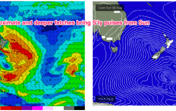
Winds off the Tasmanian coast and up into Bass Strait are tending more N’ly over the short term producing some small NE windswell.
There's nothing to recommend this week with a funky S/SE swell this weekend.