Fun waves from Wed on a SE surge
Monday, 2 September 2024
Fun waves from Wed on a SE surge
Monday, 2 September 2024
We’ll see a SE surge with the high pressure ridge and a small increase in swell from Wed across the CQ coast.
We’ll see a SE surge with the high pressure ridge and a small increase in swell from Wed across the CQ coast.
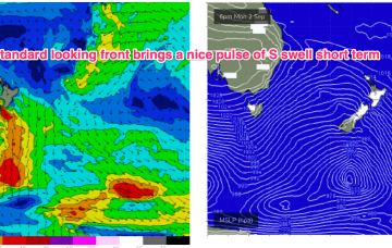
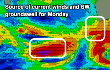
The front brings a bog standard blast of winter/spring style S swell through the short term, with the high quickly moving into the Tasman
The front brings a bog standard blast of winter/spring style S swell through the short term, with the high quickly moving into the Tasman.
The west swells will continue as winds ease and windows open up inside the gulf.
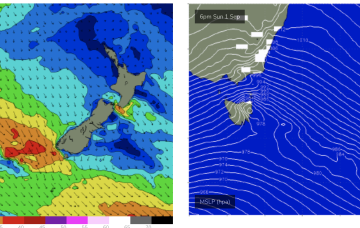
After strong winds and unseasonal heat build ups we’ll see a more typical seasonal pattern for the short term with a high in the bight and a strong front pushing into the Tasman as a parent low slips under Tasmania.
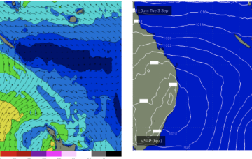
The coming week will see a general downwards trend in size from tomorrow morning with a little less wind.
While west in nature, there'll be no issue with size across the region.
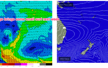
We’ll see stronger SE surf develop Wed/Thurs as a SE surge propagates up the QLD coast from a strong high pressure ridge
Give the weekend a miss with Monday looking best of the period for now.
Gales out of Bass Strait get more of a NW tilt o/night into Sat morning which should generate another round of N’ly windswell.