Surfable days easing into the mid week
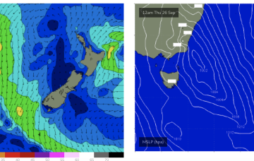
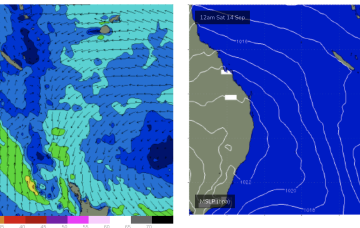
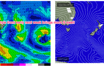
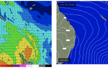
The current SE surge from the high has produced more surfable conditions across CQ, which will ease into the middle of this week.
By mid next week we may see freshening N-NE flow off the South Coast into Bass Strait generate some NE windswell, possibly sizey.
More frontal activity is expected later this week continuing the pattern of episodic S swells with generally favourable winds.
There's one morning to focus on this week.
A reactivation of the Southern Ocean storm track should bring large, back to back swells for the South Coast.
After a spell of early spring heat the synoptic pattern has reversed back to a more winter style situation with frontal activity pushing into the Tasman, backed by a strong high (1040hPa) in the Bight. We’ll see this high rapidly weaken and move up over NSW and into the Tasman this week while zonal fronts continue westerly ridging below Tasmania and bring mostly offshore winds to temperate NSW.
We've got plenty of swell energy over the coming days ahead of larger, more powerful surf late week through early next week.
The SE surge from the current high will see small waves over the weekend.
We have a follow-up front and trough expected to push into the Tasman later Sat, this time backed by a monster high (1042 hPa) in the Bight. Steep pressure gradients will create near gales to gales in a proximate S’ly fetch and whip up plenty of sizey S swell later Sat.
Conditions are looking dicey for the weekend and Monday, better from Tuesday.